Fresne-Saint-Mamès geodata
Fresne-Saint-Mamès (Bourgogne-Franche-Comté) is a populated place; located in France in Europe/Paris (GMT+2) time zone. With population of 520 people, there are 14814 cities with bigger population in this country. Compared to other cities in France, 51.9% of cities are located further ↓South; 85.6% of cities are located further ←West and 67.6% of cities have lower elevation than Fresne-Saint-Mamès. Note1
Administrative division(s):
- Level 1: Bourgogne-Franche-Comté
- Level 2: Département de la Haute-Saône
- Level 3: Arrondissement de Vesoul
- Level 4: Fresne-Saint-Mamès


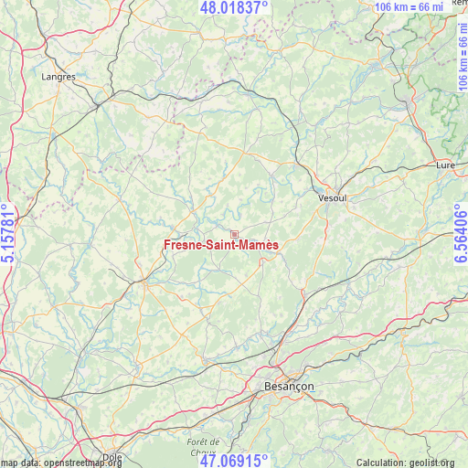
Fresne-Saint-Mamès GPS coordinates[2]
47° 32' 45.276" North, 5° 51' 39.348" East
| Map corner | latitude | longitude |
|---|---|---|
| Upper-left | 48.01837°, | 5.15781° |
| Center: | 47.54591°, | 5.86093° |
| Lower-right: | 47.06915°, | 6.56406° |
| Map W x H: | 105.5×105.5 km | = 65.6×65.6mi |
| max Lat: | 51.07786° ⇑48.1% North |
| Fresne-Saint-Mamès: | 47.54591° |
| min Lat: | ⇓51.9% South 41.3874° |
| min Long | Fresne-Saint-Ma | max Long |
| -5.08615° | 5.86093° | 9.52242° |
| W 85.6%⇐ | ⇒14.4% E |
Elevation
Elevation of Fresne-Saint-Mamès is 207 m = 679 ft, and this is 13.3 m = 44 ft above average elevation for this country.
| Max E: |
2333 m = 7654 ft | 32.4% |
| Fresne-Saint-Mamès | 207 m 679 ft | |
| Avg. | 193.7 m = 635 ft | |
Min E: |
-1 m = -3 ft | 67.6% |
See also: France elevation on elevation.city.
Geographical zone
Fresne-Saint-Mamès is located in North temperate zone (between Tropic of Cancer and the Arctic Circle). Distance of this North polar circle is 2114.6 km =1314 mi to North.| Distance of | km | miles | from Fresne-Saint-Mamès |
|---|---|---|---|
| North Pole | 4720.5 | 2933.2 | to North |
| Arctic Circle | 2114.6 | 1314 | to North |
| Tropic Cancer | 2680.7 | 1665.7 | to South |
| Equator | 5286.6 | 3284.9 | to South |


Nearby cities:
15 places around Fresne-Saint-Mamès: (largest is in red/bold)
• Beaujeu-Saint-Vallier-Pierrejux-et-Quitteur
14.3 km =8.9 mi,  249°
249°
• Boult
21.1 km =13.1 mi,  150°
150°
• Bucey-lès-Gy
13.7 km =8.5 mi,  185°
185°
• Combeaufontaine
18.4 km =11.4 mi,  7°
7°
• Dampierre-sur-Salon
13.7 km =8.5 mi,  275°
275°
• Fretigney-et-Velloreille
8.8 km =5.5 mi,  141°
141°
• Gy
16 km =9.9 mi, 193°
• Mailley-et-Chazelot
14.4 km =8.9 mi,  93°
93°
• Montigny-lès-Vesoul
18.9 km =11.7 mi,  57°
57°
• Noidans-le-Ferroux
7.5 km =4.7 mi,  69°
69°
• Rigny
19.2 km =11.9 mi,  244°
244°
• Rioz
20.4 km =12.7 mi,  131°
131°
• Scey-sur-Saône-et-Saint-Albin
15.6 km =9.7 mi,  32°
32°
• Vaivre-et-Montoille
20.5 km =12.7 mi, 62°
• Vellexon-Queutrey-et-Vaudey
5.1 km =3.2 mi,  296°
296°
Sources, notices
• [Note1] Compared only with cities in France existing in our database
• [Src1] Map data: © OpenStreetMap contributors (CC-BY-SA)
• [Src2] Other city data from geonames.org with taken over terms of usage.
• [Src3] Geographical zone / Annual Mean Temperature by Robert A. Rohde @ Wikipedia
