Saulce-sur-Rhône geodata
Saulce-sur-Rhône (Auvergne-Rhône-Alpes) is a populated place; located in France in Europe/Paris (GMT+2) time zone. With population of 1,711 people, there are 5491 cities with bigger population in this country. Compared to other cities in France, 82.1% of cities are located further ↑North; 75.1% of cities are located further ←West and 53.9% of cities have lower elevation than Saulce-sur-Rhône. Note1
Administrative division(s):
- Level 1: Auvergne-Rhône-Alpes
- Level 2: Département de la Drôme
- Level 3: Arrondissement de Nyons
- Level 4: Saulce-sur-Rhône


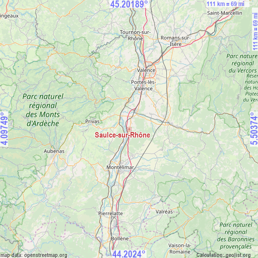
Saulce-sur-Rhône GPS coordinates[2]
44° 42' 15.48" North, 4° 48' 2.196" East
| Map corner | latitude | longitude |
|---|---|---|
| Upper-left | 45.20189°, | 4.09749° |
| Center: | 44.7043°, | 4.80061° |
| Lower-right: | 44.2024°, | 5.50374° |
| Map W x H: | 111.1×111.1 km | = 69×69mi |
| max Lat: | 51.07786° ⇑82.1% North |
| Saulce-sur-Rhône: | 44.7043° |
| min Lat: | ⇓17.9% South 41.3874° |
| min Long | Saulce-sur-Rhô | max Long |
| -5.08615° | 4.80061° | 9.52242° |
| W 75.1%⇐ | ⇒24.9% E |
Elevation
Elevation of Saulce-sur-Rhône is 146 m = 479 ft, and this is 47.7 m = 156 ft below average elevation for this country.
| Max E: |
2333 m = 7654 ft | 46.1% |
| Avg. | 193.7 m = 635 ft | |
| Saulce-sur-Rhône | 146 m = 479 ft | |
Min E: |
-1 m = -3 ft | 53.9% |
See also: France elevation on elevation.city.
Geographical zone
Saulce-sur-Rhône is located in North temperate zone (between Tropic of Cancer and the Arctic Circle). Distance of this Northern Tropic circle is 2364.7 km =1469.4 mi to South.| Distance of | km | miles | from Saulce-sur-Rhône |
|---|---|---|---|
| North Pole | 5036.4 | 3129.5 | to North |
| Arctic Circle | 2430.5 | 1510.2 | to North |
| Tropic Cancer | 2364.7 | 1469.4 | to South |
| Equator | 4970.7 | 3088.6 | to South |


Nearby cities:
15 places around Saulce-sur-Rhône: (largest is in red/bold)
• Baix
3 km =1.9 mi,  287°
287°
• Cliousclat
2.9 km =1.8 mi,  60°
60°
• Cruas
6 km =3.7 mi,  209°
209°
• Grane
10.1 km =6.3 mi,  71°
71°
• La Coucourde
6.3 km =3.9 mi,  192°
192°
• Le Pouzin
6.7 km =4.2 mi,  321°
321°
• Livron-sur-Drôme
8.7 km =5.4 mi,  21°
21°
• Loriol-sur-Drôme
4.9 km =3 mi, 15°
• Marsanne
9.1 km =5.7 mi,  139°
139°
• Mirmande
2.8 km =1.7 mi,  102°
102°
• Rompon
9.5 km =5.9 mi,  325°
325°
• Saint-Julien-en-Saint-Alban
9.9 km =6.2 mi,  304°
304°
• Saint-Lager-Bressac
7.3 km =4.5 mi,  259°
259°
• Saint-Symphorien-sous-Chomérac
7.8 km =4.8 mi,  282°
282°
• Saint-Vincent-de-Barrès
8.6 km =5.3 mi,  236°
236°
Sources, notices
• [Note1] Compared only with cities in France existing in our database
• [Src1] Map data: © OpenStreetMap contributors (CC-BY-SA)
• [Src2] Other city data from geonames.org with taken over terms of usage.
• [Src3] Geographical zone / Annual Mean Temperature by Robert A. Rohde @ Wikipedia
