Livron-sur-Drôme geodata
Livron-sur-Drôme (Auvergne-Rhône-Alpes) is a populated place; located in France in Europe/Paris (GMT+2) time zone. With population of 8,440 people, there are 1150 cities with bigger population in this country. Compared to other cities in France, 81.6% of cities are located further ↑North; 75.7% of cities are located further ←West and 52.3% of cities have higher elevation than Livron-sur-Drôme. Note1
Administrative division(s):
- Level 1: Auvergne-Rhône-Alpes
- Level 2: Département de la Drôme
- Level 3: Arrondissement de Die
- Level 4: Livron-sur-Drôme


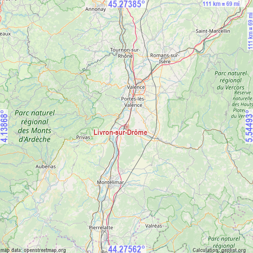
Livron-sur-Drôme GPS coordinates[2]
44° 46' 36.804" North, 4° 50' 30.48" East
| Map corner | latitude | longitude |
|---|---|---|
| Upper-left | 45.27385°, | 4.13868° |
| Center: | 44.77689°, | 4.8418° |
| Lower-right: | 44.27562°, | 5.54493° |
| Map W x H: | 111×111 km | = 69×69mi |
| max Lat: | 51.07786° ⇑81.6% North |
| Livron-sur-Drôme: | 44.77689° |
| min Lat: | ⇓18.4% South 41.3874° |
| min Long | Livron-sur-Drô | max Long |
| -5.08615° | 4.8418° | 9.52242° |
| W 75.7%⇐ | ⇒24.3% E |
Elevation
Elevation of Livron-sur-Drôme is 124 m = 407 ft, and this is 69.7 m = 229 ft below average elevation for this country.
| Max E: |
2333 m = 7654 ft | 52.3% |
| Avg. | 193.7 m = 635 ft | |
| Livron-sur-Drôme | 124 m = 407 ft | |
Min E: |
-1 m = -3 ft | 47.7% |
See also: France elevation on elevation.city.
Geographical zone
Livron-sur-Drôme is located in North temperate zone (between Tropic of Cancer and the Arctic Circle). Distance of this Northern Tropic circle is 2372.8 km =1474.4 mi to South.| Distance of | km | miles | from Livron-sur-Drôme |
|---|---|---|---|
| North Pole | 5028.3 | 3124.4 | to North |
| Arctic Circle | 2422.5 | 1505.3 | to North |
| Tropic Cancer | 2372.8 | 1474.4 | to South |
| Equator | 4978.7 | 3093.6 | to South |


Nearby cities:
15 places around Livron-sur-Drôme: (largest is in red/bold)
• Allex
4.6 km =2.9 mi,  102°
102°
• Baix
9.4 km =5.8 mi,  220°
220°
• Beauchastel
6.2 km =3.9 mi,  330°
330°
• Cliousclat
6.7 km =4.2 mi,  186°
186°
• Grane
8 km =5 mi,  127°
127°
• La Voulte-sur-Rhône
5.5 km =3.4 mi,  297°
297°
• Le Pouzin
7.9 km =4.9 mi,  249°
249°
• Loriol-sur-Drôme
3.8 km =2.4 mi,  210°
210°
• Mirmande
8.7 km =5.4 mi,  183°
183°
• Montoison
8.1 km =5 mi,  74°
74°
• Rompon
8.6 km =5.3 mi,  268°
268°
• Saint-Georges-les-Bains
9.7 km =6 mi,  344°
344°
• Saint-Laurent-du-Pape
7.9 km =4.9 mi,  311°
311°
• Saulce-sur-Rhône
8.7 km =5.4 mi,  201°
201°
• Étoile-sur-Rhône
7.9 km =4.9 mi,  29°
29°
Sources, notices
• [Note1] Compared only with cities in France existing in our database
• [Src1] Map data: © OpenStreetMap contributors (CC-BY-SA)
• [Src2] Other city data from geonames.org with taken over terms of usage.
• [Src3] Geographical zone / Annual Mean Temperature by Robert A. Rohde @ Wikipedia
