Sarrewerden geodata
Sarrewerden (Grand Est) is a populated place; located in France in Europe/Paris (GMT+2) time zone. With population of 1,085 people, there are 8226 cities with bigger population in this country. Compared to other cities in France, 78% of cities are located further ↓South; 95.2% of cities are located further ←West and 72% of cities have lower elevation than Sarrewerden. Note1
Administrative division(s):
- Level 1: Grand Est
- Level 2: Bas-Rhin
- Level 3: Arrondissement de Saverne
- Level 4: Sarrewerden


Sarrewerden GPS coordinates[2]
48° 55' 21.396" North, 7° 5' 2.832" East
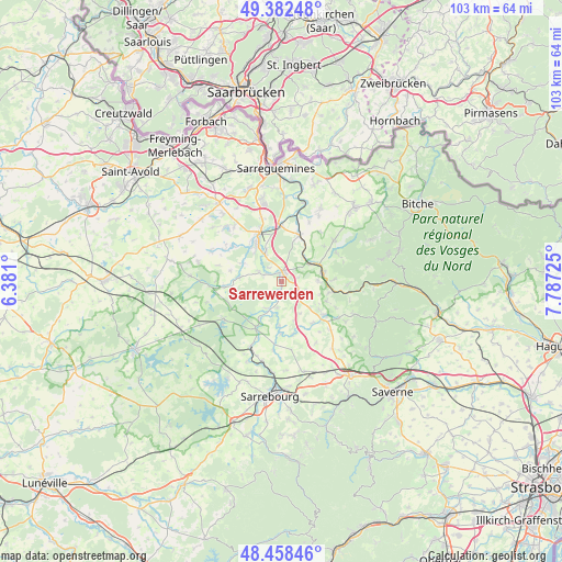
| Map corner | latitude | longitude |
|---|---|---|
| Upper-left | 49.38248°, | 6.381° |
| Center: | 48.92261°, | 7.08412° |
| Lower-right: | 48.45846°, | 7.78725° |
| Map W x H: | 102.7×102.7 km | = 63.8×63.8mi |
| max Lat: | 51.07786° ⇑22% North |
| Sarrewerden: | 48.92261° |
| min Lat: | ⇓78% South 41.3874° |
| min Long | Sarrewerden | max Long |
| -5.08615° | 7.08412° | 9.52242° |
| W 95.2%⇐ | ⇒4.8% E |
Elevation
Elevation of Sarrewerden is 230 m = 755 ft, and this is 36.3 m = 119 ft above average elevation for this country.
| Max E: |
2333 m = 7654 ft | 28% |
| Sarrewerden | 230 m 755 ft | |
| Avg. | 193.7 m = 635 ft | |
Min E: |
-1 m = -3 ft | 72% |
See also: France elevation on elevation.city.
Geographical zone
Sarrewerden is located in North temperate zone (between Tropic of Cancer and the Arctic Circle). Distance of this North polar circle is 1961.5 km =1218.8 mi to North.| Distance of | km | miles | from Sarrewerden |
|---|---|---|---|
| North Pole | 4567.4 | 2838 | to North |
| Arctic Circle | 1961.5 | 1218.8 | to North |
| Tropic Cancer | 2833.8 | 1760.8 | to South |
| Equator | 5439.7 | 3380.1 | to South |


Nearby cities:
15 places around Sarrewerden: (largest is in red/bold)
• Butten
11.4 km =7.1 mi,  62°
62°
• Diemeringen
7.9 km =4.9 mi,  75°
75°
• Drulingen
9.8 km =6.1 mi,  128°
128°
• Fénétrange
9.5 km =5.9 mi,  207°
207°
• Harskirchen
3.7 km =2.3 mi,  289°
289°
• Herbitzheim
10.3 km =6.4 mi,  359°
359°
• Keskastel
6.2 km =3.9 mi,  331°
331°
• Le Val-de-Guéblange
11 km =6.8 mi,  306°
306°
• Mackwiller
6.7 km =4.2 mi,  87°
87°
• Oermingen
9.3 km =5.8 mi,  20°
20°
• Sarralbe
9.3 km =5.8 mi,  335°
335°
• Sarre-Union
1.9 km =1.2 mi, 22°
• Waldhambach
9.7 km =6 mi, 87°
• Weyer
9.4 km =5.8 mi,  143°
143°
• Willerwald
11.9 km =7.4 mi, 343°
Sources, notices
• [Note1] Compared only with cities in France existing in our database
• [Src1] Map data: © OpenStreetMap contributors (CC-BY-SA)
• [Src2] Other city data from geonames.org with taken over terms of usage.
• [Src3] Geographical zone / Annual Mean Temperature by Robert A. Rohde @ Wikipedia
