Saou geodata
Saou (Auvergne-Rhône-Alpes) is a populated place; located in France in Europe/Paris (GMT+2) time zone. With population of 513 people, there are 14965 cities with bigger population in this country. Compared to other cities in France, 82.5% of cities are located further ↑North; 78.4% of cities are located further ←West and 86.7% of cities have lower elevation than Saou. Note1
Administrative division(s):
- Level 1: Auvergne-Rhône-Alpes
- Level 2: Département de la Drôme
- Level 3: Arrondissement de Die
- Level 4: Saou


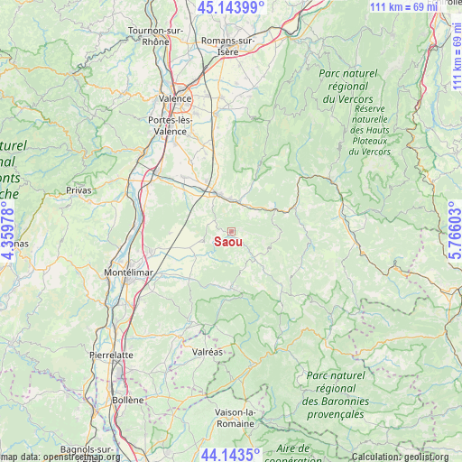
Saou GPS coordinates[2]
44° 38' 45.24" North, 5° 3' 46.476" East
| Map corner | latitude | longitude |
|---|---|---|
| Upper-left | 45.14399°, | 4.35978° |
| Center: | 44.6459°, | 5.06291° |
| Lower-right: | 44.1435°, | 5.76603° |
| Map W x H: | 111.2×111.2 km | = 69.1×69.1mi |
| max Lat: | 51.07786° ⇑82.5% North |
| Saou: | 44.6459° |
| min Lat: | ⇓17.5% South 41.3874° |
| min Long | Saou | max Long |
| -5.08615° | 5.06291° | 9.52242° |
| W 78.4%⇐ | ⇒21.6% E |
Elevation
Elevation of Saou is 369 m = 1211 ft, and this is 175.3 m = 575 ft above average elevation for this country.
| Max E: |
2333 m = 7654 ft | 13.3% |
| Saou | 369 m 1211 ft | |
| Avg. | 193.7 m = 635 ft | |
Min E: |
-1 m = -3 ft | 86.7% |
See also: France elevation on elevation.city.
Geographical zone
Saou is located in North temperate zone (between Tropic of Cancer and the Arctic Circle). Distance of this Northern Tropic circle is 2358.2 km =1465.3 mi to South.| Distance of | km | miles | from Saou |
|---|---|---|---|
| North Pole | 5042.9 | 3133.5 | to North |
| Arctic Circle | 2437 | 1514.3 | to North |
| Tropic Cancer | 2358.2 | 1465.3 | to South |
| Equator | 4964.2 | 3084.6 | to South |


Nearby cities:
15 places around Saou: (largest is in red/bold)
• Aouste-sur-Sye
8.1 km =5 mi,  355°
355°
• Bourdeaux
8.8 km =5.5 mi,  139°
139°
• Chabrillan
12.9 km =8 mi,  311°
311°
• Charols
10.7 km =6.6 mi,  234°
234°
• Cléon-d’Andran
10.8 km =6.7 mi,  249°
249°
• Crest
9.7 km =6 mi,  337°
337°
• Dieulefit
13.4 km =8.3 mi,  180°
180°
• Eurre
13.8 km =8.6 mi,  334°
334°
• Haut Divajeu
7.4 km =4.6 mi, 330°
• Le Poët-Laval
12.7 km =7.9 mi,  197°
197°
• Mirabel-et-Blacons
8.3 km =5.2 mi,  25°
25°
• Piégros-la-Clastre
4.8 km =3 mi,  36°
36°
• Puy-Saint-Martin
7.4 km =4.6 mi,  255°
255°
• Saillans
11 km =6.8 mi,  59°
59°
• Vaunaveys-la-Rochette
13.6 km =8.5 mi,  350°
350°
Sources, notices
• [Note1] Compared only with cities in France existing in our database
• [Src1] Map data: © OpenStreetMap contributors (CC-BY-SA)
• [Src2] Other city data from geonames.org with taken over terms of usage.
• [Src3] Geographical zone / Annual Mean Temperature by Robert A. Rohde @ Wikipedia
