Saillans geodata
Saillans (Auvergne-Rhône-Alpes) is a populated place; located in France in Europe/Paris (GMT+2) time zone. With population of 969 people, there are 9068 cities with bigger population in this country. Compared to other cities in France, 82.1% of cities are located further ↑North; 79.6% of cities are located further ←West and 77.1% of cities have lower elevation than Saillans. Note1
Administrative division(s):
- Level 1: Auvergne-Rhône-Alpes
- Level 2: Département de la Drôme
- Level 3: Arrondissement de Die
- Level 4: Saillans


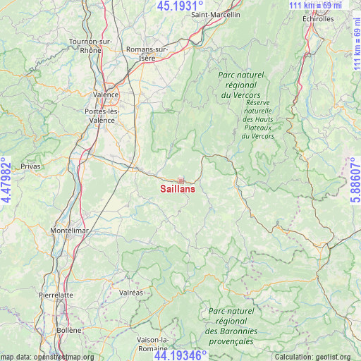
Saillans GPS coordinates[2]
44° 41' 43.584" North, 5° 10' 58.584" East
| Map corner | latitude | longitude |
|---|---|---|
| Upper-left | 45.1931°, | 4.47982° |
| Center: | 44.69544°, | 5.18294° |
| Lower-right: | 44.19346°, | 5.88607° |
| Map W x H: | 111.1×111.1 km | = 69×69mi |
| max Lat: | 51.07786° ⇑82.1% North |
| Saillans: | 44.69544° |
| min Lat: | ⇓17.9% South 41.3874° |
| min Long | Saillans | max Long |
| -5.08615° | 5.18294° | 9.52242° |
| W 79.6%⇐ | ⇒20.4% E |
Elevation
Elevation of Saillans is 264 m = 866 ft, and this is 70.3 m = 231 ft above average elevation for this country.
| Max E: |
2333 m = 7654 ft | 22.9% |
| Saillans | 264 m 866 ft | |
| Avg. | 193.7 m = 635 ft | |
Min E: |
-1 m = -3 ft | 77.1% |
See also: France elevation on elevation.city.
Geographical zone
Saillans is located in North temperate zone (between Tropic of Cancer and the Arctic Circle). Distance of this Northern Tropic circle is 2363.7 km =1468.7 mi to South.| Distance of | km | miles | from Saillans |
|---|---|---|---|
| North Pole | 5037.4 | 3130.1 | to North |
| Arctic Circle | 2431.5 | 1510.9 | to North |
| Tropic Cancer | 2363.7 | 1468.7 | to South |
| Equator | 4969.7 | 3088 | to South |


Nearby cities:
15 places around Saillans: (largest is in red/bold)
• Aouste-sur-Sye
10.5 km =6.5 mi,  283°
283°
• Bourdeaux
12.7 km =7.9 mi,  196°
196°
• Chabrillan
19.4 km =12.1 mi, 279°
• Crest
13.7 km =8.5 mi, 284°
• Die
16.2 km =10.1 mi,  66°
66°
• Dieulefit
21.2 km =13.2 mi,  206°
206°
• Eurre
16.9 km =10.5 mi,  294°
294°
• Grane
21 km =13 mi, 281°
• Haut Divajeu
13.2 km =8.2 mi,  273°
273°
• Mirabel-et-Blacons
6.3 km =3.9 mi, 288°
• Piégros-la-Clastre
6.8 km =4.2 mi,  256°
256°
• Puy-Saint-Martin
18.2 km =11.3 mi,  246°
246°
• Saou
11 km =6.8 mi,  239°
239°
• Upie
20.2 km =12.6 mi,  306°
306°
• Vaunaveys-la-Rochette
14.2 km =8.8 mi,  303°
303°
Sources, notices
• [Note1] Compared only with cities in France existing in our database
• [Src1] Map data: © OpenStreetMap contributors (CC-BY-SA)
• [Src2] Other city data from geonames.org with taken over terms of usage.
• [Src3] Geographical zone / Annual Mean Temperature by Robert A. Rohde @ Wikipedia
