Sancergues geodata
Sancergues (Centre) is a populated place; located in France in Europe/Paris (GMT+2) time zone. With population of 726 people, there are 11454 cities with bigger population in this country. Compared to other cities in France, 53.6% of cities are located further ↑North; 56.6% of cities are located further ←West and 60% of cities have lower elevation than Sancergues. Note1
Administrative division(s):
- Level 1: Centre
- Level 2: Cher
- Level 3: Arrondissement de Bourges
- Level 4: Sancergues


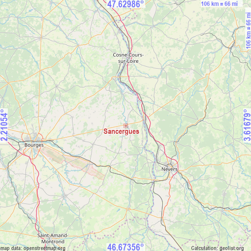
Sancergues GPS coordinates[2]
47° 9' 13.896" North, 2° 54' 49.212" East
| Map corner | latitude | longitude |
|---|---|---|
| Upper-left | 47.62986°, | 2.21054° |
| Center: | 47.15386°, | 2.91367° |
| Lower-right: | 46.67356°, | 3.61679° |
| Map W x H: | 106.3×106.3 km | = 66.1×66.1mi |
| max Lat: | 51.07786° ⇑53.6% North |
| Sancergues: | 47.15386° |
| min Lat: | ⇓46.4% South 41.3874° |
| min Long | Sancergues | max Long |
| -5.08615° | 2.91367° | 9.52242° |
| W 56.6%⇐ | ⇒43.4% E |
Elevation
Elevation of Sancergues is 170 m = 558 ft, and this is 23.7 m = 78 ft below average elevation for this country.
| Max E: |
2333 m = 7654 ft | 40% |
| Avg. | 193.7 m = 635 ft | |
| Sancergues | 170 m = 558 ft | |
Min E: |
-1 m = -3 ft | 60% |
See also: France elevation on elevation.city.
Geographical zone
Sancergues is located in North temperate zone (between Tropic of Cancer and the Arctic Circle). Distance of this North polar circle is 2158.2 km =1341 mi to North.| Distance of | km | miles | from Sancergues |
|---|---|---|---|
| North Pole | 4764 | 2960.2 | to North |
| Arctic Circle | 2158.2 | 1341 | to North |
| Tropic Cancer | 2637.1 | 1638.6 | to South |
| Equator | 5243 | 3257.8 | to South |


Nearby cities:
15 places around Sancergues: (largest is in red/bold)
• Beffes
9.8 km =6.1 mi,  132°
132°
• Chaulgnes
14.6 km =9.1 mi,  100°
100°
• Germigny-sur-Loire
12 km =7.5 mi, 130°
• Herry
7.6 km =4.7 mi,  23°
23°
• Jouet-sur-l'Aubois
13.3 km =8.3 mi,  155°
155°
• Jussy-le-Chaudrier
3.3 km =2.1 mi,  151°
151°
• La Charité-sur-Loire
8.4 km =5.2 mi,  67°
67°
• La Marche
9.2 km =5.7 mi, 99°
• Marseilles-lès-Aubigny
12.2 km =7.6 mi,  142°
142°
• Mesves-sur-Loire
11.5 km =7.1 mi,  30°
30°
• Narcy
15 km =9.3 mi,  51°
51°
• Pouilly-sur-Loire
14.8 km =9.2 mi,  12°
12°
• Raveau
12.9 km =8 mi, 73°
• Torteron
15.1 km =9.4 mi, 164°
• Varennes-lès-Narcy
14.2 km =8.8 mi, 52°
Sources, notices
• [Note1] Compared only with cities in France existing in our database
• [Src1] Map data: © OpenStreetMap contributors (CC-BY-SA)
• [Src2] Other city data from geonames.org with taken over terms of usage.
• [Src3] Geographical zone / Annual Mean Temperature by Robert A. Rohde @ Wikipedia
