Herry geodata
Herry (Centre) is a populated place; located in France in Europe/Paris (GMT+2) time zone. With population of 1,026 people, there are 8645 cities with bigger population in this country. Compared to other cities in France, 52.8% of cities are located further ↑North; 57.2% of cities are located further ←West and 58% of cities have lower elevation than Herry. Note1
Administrative division(s):
- Level 1: Centre
- Level 2: Cher
- Level 3: Arrondissement de Bourges
- Level 4: Herry


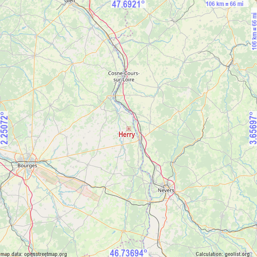
Herry GPS coordinates[2]
47° 13' 0.012" North, 2° 57' 13.86" East
| Map corner | latitude | longitude |
|---|---|---|
| Upper-left | 47.6921°, | 2.25072° |
| Center: | 47.21667°, | 2.95385° |
| Lower-right: | 46.73694°, | 3.65697° |
| Map W x H: | 106.2×106.2 km | = 66×66mi |
| max Lat: | 51.07786° ⇑52.8% North |
| Herry: | 47.21667° |
| min Lat: | ⇓47.2% South 41.3874° |
| min Long | Herry | max Long |
| -5.08615° | 2.95385° | 9.52242° |
| W 57.2%⇐ | ⇒42.8% E |
Elevation
Elevation of Herry is 161 m = 528 ft, and this is 32.7 m = 107 ft below average elevation for this country.
| Max E: |
2333 m = 7654 ft | 42% |
| Avg. | 193.7 m = 635 ft | |
| Herry | 161 m = 528 ft | |
Min E: |
-1 m = -3 ft | 58% |
See also: France elevation on elevation.city.
Geographical zone
Herry is located in North temperate zone (between Tropic of Cancer and the Arctic Circle). Distance of this North polar circle is 2151.2 km =1336.7 mi to North.| Distance of | km | miles | from Herry |
|---|---|---|---|
| North Pole | 4757.1 | 2955.9 | to North |
| Arctic Circle | 2151.2 | 1336.7 | to North |
| Tropic Cancer | 2644.1 | 1643 | to South |
| Equator | 5250 | 3262.2 | to South |


Nearby cities:
15 places around Herry: (largest is in red/bold)
• Beffes
14.2 km =8.8 mi,  163°
163°
• Chaulgnes
14.9 km =9.3 mi,  130°
130°
• Jussy-le-Chaudrier
10 km =6.2 mi,  188°
188°
• La Charité-sur-Loire
6 km =3.7 mi, 127°
• La Marche
10.5 km =6.5 mi,  144°
144°
• Mesves-sur-Loire
4.1 km =2.5 mi,  44°
44°
• Narcy
9 km =5.6 mi,  75°
75°
• Pouilly-sur-Loire
7.5 km =4.7 mi,  0°
0°
• Raveau
9.9 km =6.2 mi,  109°
109°
• Saint-Andelain
10.3 km =6.4 mi, 2°
• Sancergues
7.6 km =4.7 mi,  203°
203°
• Sancerre
15.4 km =9.6 mi,  324°
324°
• Tracy-sur-Loire
12.5 km =7.8 mi,  336°
336°
• Varennes-lès-Narcy
8.4 km =5.2 mi, 78°
• Veaugues
15.5 km =9.6 mi,  286°
286°
Sources, notices
• [Note1] Compared only with cities in France existing in our database
• [Src1] Map data: © OpenStreetMap contributors (CC-BY-SA)
• [Src2] Other city data from geonames.org with taken over terms of usage.
• [Src3] Geographical zone / Annual Mean Temperature by Robert A. Rohde @ Wikipedia
