Saint-Yon geodata
Saint-Yon (Île-de-France) is a populated place; located in France in Europe/Paris (GMT+2) time zone. With population of 863 people, there are 9962 cities with bigger population in this country. Compared to other cities in France, 69.7% of cities are located further ↓South; 54.6% of cities are located further →East and 51.9% of cities have lower elevation than Saint-Yon. Note1
Administrative division(s):
- Level 1: Île-de-France
- Level 2: Département de l'Essonne
- Level 3: Arrondissement d'Étampes
- Level 4: Saint-Yon


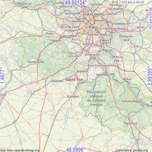
Saint-Yon GPS coordinates[2]
48° 33' 29.196" North, 2° 11' 26.952" East
| Map corner | latitude | longitude |
|---|---|---|
| Upper-left | 49.02134°, | 1.4877° |
| Center: | 48.55811°, | 2.19082° |
| Lower-right: | 48.0906°, | 2.89395° |
| Map W x H: | 103.5×103.5 km | = 64.3×64.3mi |
| max Lat: | 51.07786° ⇑30.3% North |
| Saint-Yon: | 48.55811° |
| min Lat: | ⇓69.7% South 41.3874° |
| min Long | Saint-Yon | max Long |
| -5.08615° | 2.19082° | 9.52242° |
| W 45.4%⇐ | ⇒54.6% E |
Elevation
Elevation of Saint-Yon is 139 m = 456 ft, and this is 54.7 m = 179 ft below average elevation for this country.
| Max E: |
2333 m = 7654 ft | 48.1% |
| Avg. | 193.7 m = 635 ft | |
| Saint-Yon | 139 m = 456 ft | |
Min E: |
-1 m = -3 ft | 51.9% |
See also: France elevation on elevation.city.
Geographical zone
Saint-Yon is located in North temperate zone (between Tropic of Cancer and the Arctic Circle). Distance of this North polar circle is 2002 km =1244 mi to North.| Distance of | km | miles | from Saint-Yon |
|---|---|---|---|
| North Pole | 4607.9 | 2863.2 | to North |
| Arctic Circle | 2002 | 1244 | to North |
| Tropic Cancer | 2793.2 | 1735.6 | to South |
| Equator | 5399.2 | 3354.9 | to South |


Nearby cities:
15 places around Saint-Yon: (largest is in red/bold)
• Arpajon
5.3 km =3.3 mi,  50°
50°
• Avrainville
4.1 km =2.5 mi,  82°
82°
• Boissy-sous-Saint-Yon
1.6 km =1 mi,  107°
107°
• Breuillet
1.9 km =1.2 mi,  318°
318°
• Bruyères-le-Châtel
3.4 km =2.1 mi,  358°
358°
• Chamarande
4.9 km =3 mi,  156°
156°
• Cheptainville
6.4 km =4 mi,  97°
97°
• Courson-Monteloup
5.6 km =3.5 mi,  327°
327°
• Guibeville
6.1 km =3.8 mi, 76°
• La Norville
5.9 km =3.7 mi,  62°
62°
• Ollainville
4.2 km =2.6 mi,  30°
30°
• Saint-Chéron
4.9 km =3 mi,  265°
265°
• Saint-Maurice-Montcouronne
5.6 km =3.5 mi,  299°
299°
• Villeconin
6.9 km =4.3 mi,  224°
224°
• Égly
3.3 km =2.1 mi, 47°
Sources, notices
• [Note1] Compared only with cities in France existing in our database
• [Src1] Map data: © OpenStreetMap contributors (CC-BY-SA)
• [Src2] Other city data from geonames.org with taken over terms of usage.
• [Src3] Geographical zone / Annual Mean Temperature by Robert A. Rohde @ Wikipedia
