Saint-Vaast-lès-Mello geodata
Saint-Vaast-lès-Mello (Hauts-de-France) is a populated place; located in France in Europe/Paris (GMT+2) time zone. With population of 859 people, there are 9999 cities with bigger population in this country. Compared to other cities in France, 85.5% of cities are located further ↓South; 51.2% of cities are located further →East and 74.6% of cities have higher elevation than Saint-Vaast-lès-Mello. Note1
Administrative division(s):
- Level 1: Hauts-de-France
- Level 2: Département de l'Oise
- Level 3: Arrondissement de Senlis
- Level 4: Saint-Vaast-lès-Mello
Current local time in Saint-Vaast-lès-Mello:
06:47 AM, SaturdayDifference from your time zone: hours


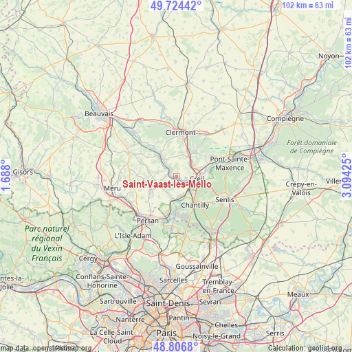
Saint-Vaast-lès-Mello GPS coordinates[2]
49° 16' 3.864" North, 2° 23' 28.032" East
| Map corner | latitude | longitude |
|---|---|---|
| Upper-left | 49.72442°, | 1.688° |
| Center: | 49.26774°, | 2.39112° |
| Lower-right: | 48.8068°, | 3.09425° |
| Map W x H: | 102×102 km | = 63.4×63.4mi |
| max Lat: | 51.07786° ⇑14.5% North |
| Saint-Vaast-lès-Mello: | 49.26774° |
| min Lat: | ⇓85.5% South 41.3874° |
| min Long | Saint-Vaast-lè | max Long |
| -5.08615° | 2.39112° | 9.52242° |
| W 48.8%⇐ | ⇒51.2% E |
Elevation
Elevation of Saint-Vaast-lès-Mello is 68 m = 223 ft, and this is 125.7 m = 412 ft below average elevation for this country.
| Max E: |
2333 m = 7654 ft | 74.6% |
| Avg. | 193.7 m = 635 ft | |
| Saint-Vaast-lès-Mello | 68 m = 223 ft | |
Min E: |
-1 m = -3 ft | 25.4% |
See also: France elevation on elevation.city.
Geographical zone
Saint-Vaast-lès-Mello is located in North temperate zone (between Tropic of Cancer and the Arctic Circle). Distance of this North polar circle is 1923.1 km =1195 mi to North.| Distance of | km | miles | from Saint-Vaast-lès-Mello |
|---|---|---|---|
| North Pole | 4529 | 2814.2 | to North |
| Arctic Circle | 1923.1 | 1195 | to North |
| Tropic Cancer | 2872.1 | 1784.6 | to South |
| Equator | 5478.1 | 3403.9 | to South |


Nearby cities:
15 places around Saint-Vaast-lès-Mello: (largest is in red/bold)
• Balagny-sur-Thérain
5.1 km =3.2 mi,  308°
308°
• Blaincourt-lès-Précy
4.9 km =3 mi,  217°
217°
• Bury
6.1 km =3.8 mi,  325°
325°
• Cambronne-lès-Clermont
7 km =4.3 mi,  4°
4°
• Cires-lès-Mello
2.4 km =1.5 mi,  282°
282°
• Cramoisy
1.5 km =0.9 mi,  149°
149°
• Creil
6.9 km =4.3 mi,  100°
100°
• Laigneville
4.8 km =3 mi,  56°
56°
• Monchy-Saint-Éloi
6.1 km =3.8 mi,  65°
65°
• Montataire
3.5 km =2.2 mi,  106°
106°
• Nogent-sur-Oise
5.8 km =3.6 mi,  85°
85°
• Précy-sur-Oise
6.8 km =4.2 mi,  191°
191°
• Saint-Maximin
6.8 km =4.2 mi,  138°
138°
• Thiverny
3.7 km =2.3 mi,  118°
118°
• Villers-sous-Saint-Leu
6.2 km =3.9 mi,  177°
177°
Sources, notices
• [Note1] Compared only with cities in France existing in our database
• [Src1] Map data: © OpenStreetMap contributors (CC-BY-SA)
• [Src2] Other city data from geonames.org with taken over terms of usage.
• [Src3] Geographical zone / Annual Mean Temperature by Robert A. Rohde @ Wikipedia
