Montataire geodata
Montataire (Hauts-de-France) is a populated place; located in France in Europe/Paris (GMT+2) time zone. With population of 12,031 people, there are 799 cities with bigger population in this country. Compared to other cities in France, 85.3% of cities are located further ↓South; 50.4% of cities are located further →East and 71.4% of cities have higher elevation than Montataire. Note1
Administrative division(s):
- Level 1: Hauts-de-France
- Level 2: Département de l'Oise
- Level 3: Arrondissement de Senlis
- Level 4: Montataire


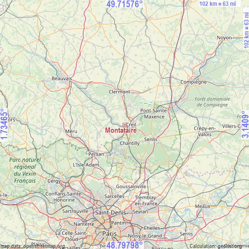
Montataire GPS coordinates[2]
49° 15' 32.4" North, 2° 26' 15.972" East
| Map corner | latitude | longitude |
|---|---|---|
| Upper-left | 49.71576°, | 1.73465° |
| Center: | 49.259°, | 2.43777° |
| Lower-right: | 48.79798°, | 3.1409° |
| Map W x H: | 102×102 km | = 63.4×63.4mi |
| max Lat: | 51.07786° ⇑14.7% North |
| Montataire: | 49.259° |
| min Lat: | ⇓85.3% South 41.3874° |
| min Long | Montataire | max Long |
| -5.08615° | 2.43777° | 9.52242° |
| W 49.6%⇐ | ⇒50.4% E |
Elevation
Elevation of Montataire is 75 m = 246 ft, and this is 118.7 m = 389 ft below average elevation for this country.
| Max E: |
2333 m = 7654 ft | 71.4% |
| Avg. | 193.7 m = 635 ft | |
| Montataire | 75 m = 246 ft | |
Min E: |
-1 m = -3 ft | 28.6% |
See also: France elevation on elevation.city.
Geographical zone
Montataire is located in North temperate zone (between Tropic of Cancer and the Arctic Circle). Distance of this North polar circle is 1924.1 km =1195.6 mi to North.| Distance of | km | miles | from Montataire |
|---|---|---|---|
| North Pole | 4530 | 2814.8 | to North |
| Arctic Circle | 1924.1 | 1195.6 | to North |
| Tropic Cancer | 2871.2 | 1784.1 | to South |
| Equator | 5477.1 | 3403.3 | to South |


Nearby cities:
15 places around Montataire: (largest is in red/bold)
• Apremont
6.4 km =4 mi,  127°
127°
• Cauffry
6.8 km =4.2 mi,  4°
4°
• Cires-lès-Mello
5.9 km =3.7 mi,  284°
284°
• Cramoisy
2.6 km =1.6 mi,  262°
262°
• Creil
3.4 km =2.1 mi,  94°
94°
• Laigneville
3.7 km =2.3 mi,  9°
9°
• Mogneville
6.7 km =4.2 mi,  21°
21°
• Monchy-Saint-Éloi
4.1 km =2.5 mi,  31°
31°
• Nogent-sur-Oise
2.8 km =1.7 mi,  59°
59°
• Saint-Maximin
4.3 km =2.7 mi,  164°
164°
• Saint-Vaast-lès-Mello
3.5 km =2.2 mi,  286°
286°
• Thiverny
0.8 km =0.5 mi,  188°
188°
• Verneuil-en-Halatte
6.7 km =4.2 mi,  70°
70°
• Villers-Saint-Paul
5 km =3.1 mi,  48°
48°
• Villers-sous-Saint-Leu
6.1 km =3.8 mi,  210°
210°
Sources, notices
• [Note1] Compared only with cities in France existing in our database
• [Src1] Map data: © OpenStreetMap contributors (CC-BY-SA)
• [Src2] Other city data from geonames.org with taken over terms of usage.
• [Src3] Geographical zone / Annual Mean Temperature by Robert A. Rohde @ Wikipedia
