Saint-Symphorien-de-Marmagne geodata
Saint-Symphorien-de-Marmagne (Bourgogne-Franche-Comté) is a populated place; located in France in Europe/Paris (GMT+2) time zone. With population of 885 people, there are 9782 cities with bigger population in this country. Compared to other cities in France, 56.8% of cities are located further ↑North; 70.8% of cities are located further ←West and 83.5% of cities have lower elevation than Saint-Symphorien-de-Marmagne. Note1
Administrative division(s):
- Level 1: Bourgogne-Franche-Comté
- Level 2: Département de Saône-et-Loire
- Level 3: Autun
- Level 4: Saint-Symphorien-de-Marmagne
Current local time in Saint-Symphorien-de-Marmagne:
11:31 AM, SaturdayDifference from your time zone: hours


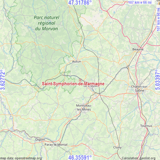
Saint-Symphorien-de-Marmagne GPS coordinates[2]
46° 50' 20.544" North, 4° 19' 51.024" East
| Map corner | latitude | longitude |
|---|---|---|
| Upper-left | 47.31786°, | 3.62772° |
| Center: | 46.83904°, | 4.33084° |
| Lower-right: | 46.35591°, | 5.03397° |
| Map W x H: | 107×107 km | = 66.5×66.5mi |
| max Lat: | 51.07786° ⇑56.8% North |
| Saint-Symphorien-de-Marmagne: | 46.83904° |
| min Lat: | ⇓43.2% South 41.3874° |
| min Long | Saint-Symphorie | max Long |
| -5.08615° | 4.33084° | 9.52242° |
| W 70.8%⇐ | ⇒29.2% E |
Elevation
Elevation of Saint-Symphorien-de-Marmagne is 328 m = 1076 ft, and this is 134.3 m = 441 ft above average elevation for this country.
| Max E: |
2333 m = 7654 ft | 16.5% |
| Saint-Symphorien-de-Marmagne | 328 m 1076 ft | |
| Avg. | 193.7 m = 635 ft | |
Min E: |
-1 m = -3 ft | 83.5% |
See also: France elevation on elevation.city.
Geographical zone
Saint-Symphorien-de-Marmagne is located in North temperate zone (between Tropic of Cancer and the Arctic Circle). Distance of this North polar circle is 2193.2 km =1362.8 mi to North.| Distance of | km | miles | from Saint-Symphorien-de-Marmagne |
|---|---|---|---|
| North Pole | 4799 | 2982 | to North |
| Arctic Circle | 2193.2 | 1362.8 | to North |
| Tropic Cancer | 2602.1 | 1616.9 | to South |
| Equator | 5208 | 3236.1 | to South |


Nearby cities:
15 places around Saint-Symphorien-de-Marmagne: (largest is in red/bold)
• Antully
9.4 km =5.8 mi,  40°
40°
• Autun
12.7 km =7.9 mi,  348°
348°
• Auxy
13.5 km =8.4 mi,  24°
24°
• Broye
4.8 km =3 mi,  319°
319°
• Laizy
12.6 km =7.8 mi,  307°
307°
• Le Breuil
11.2 km =7 mi,  108°
108°
• Le Creusot
7.4 km =4.6 mi,  118°
118°
• Marmagne
2.2 km =1.4 mi,  97°
97°
• Mesvres
7.3 km =4.5 mi,  292°
292°
• Montcenis
7.1 km =4.4 mi,  142°
142°
• Saint-Firmin
10.6 km =6.6 mi, 95°
• Saint-Pierre-de-Varennes
12.8 km =8 mi,  88°
88°
• Saint-Sernin-du-Bois
7.8 km =4.8 mi, 88°
• Torcy
12.2 km =7.6 mi,  130°
130°
• Étang-sur-Arroux
11.1 km =6.9 mi, 285°
Sources, notices
• [Note1] Compared only with cities in France existing in our database
• [Src1] Map data: © OpenStreetMap contributors (CC-BY-SA)
• [Src2] Other city data from geonames.org with taken over terms of usage.
• [Src3] Geographical zone / Annual Mean Temperature by Robert A. Rohde @ Wikipedia
