Étang-sur-Arroux geodata
Étang-sur-Arroux (Bourgogne-Franche-Comté) is a populated place; located in France in Europe/Paris (GMT+2) time zone. With population of 1,929 people, there are 4964 cities with bigger population in this country. Compared to other cities in France, 56.5% of cities are located further ↑North; 69.6% of cities are located further ←West and 78.1% of cities have lower elevation than Étang-sur-Arroux. Note1
Administrative division(s):
- Level 1: Bourgogne-Franche-Comté
- Level 2: Département de Saône-et-Loire
- Level 3: Autun
- Level 4: Étang-sur-Arroux


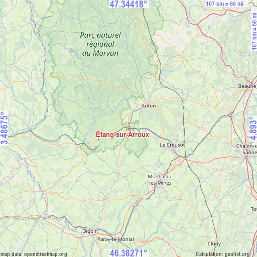
Étang-sur-Arroux GPS coordinates[2]
46° 51' 56.16" North, 4° 11' 23.568" East
| Map corner | latitude | longitude |
|---|---|---|
| Upper-left | 47.34418°, | 3.48675° |
| Center: | 46.8656°, | 4.18988° |
| Lower-right: | 46.38271°, | 4.893° |
| Map W x H: | 106.9×106.9 km | = 66.4×66.4mi |
| max Lat: | 51.07786° ⇑56.5% North |
| Étang-sur-Arroux: | 46.8656° |
| min Lat: | ⇓43.5% South 41.3874° |
| min Long | Étang-sur-Arro | max Long |
| -5.08615° | 4.18988° | 9.52242° |
| W 69.6%⇐ | ⇒30.4% E |
Elevation
Elevation of Étang-sur-Arroux is 273 m = 896 ft, and this is 79.3 m = 260 ft above average elevation for this country.
| Max E: |
2333 m = 7654 ft | 21.9% |
| Étang-sur-Arroux | 273 m 896 ft | |
| Avg. | 193.7 m = 635 ft | |
Min E: |
-1 m = -3 ft | 78.1% |
See also: France elevation on elevation.city.
Geographical zone
Étang-sur-Arroux is located in North temperate zone (between Tropic of Cancer and the Arctic Circle). Distance of this North polar circle is 2190.2 km =1360.9 mi to North.| Distance of | km | miles | from Étang-sur-Arroux |
|---|---|---|---|
| North Pole | 4796.1 | 2980.2 | to North |
| Arctic Circle | 2190.2 | 1360.9 | to North |
| Tropic Cancer | 2605 | 1618.7 | to South |
| Equator | 5211 | 3238 | to South |


Nearby cities:
15 places around Étang-sur-Arroux: (largest is in red/bold)
• Antully
17.3 km =10.7 mi,  75°
75°
• Autun
12.6 km =7.8 mi,  41°
41°
• Broye
7.7 km =4.8 mi, 84°
• La Grande-Verrière
11.6 km =7.2 mi,  341°
341°
• Laizy
4.7 km =2.9 mi,  8°
8°
• Le Creusot
18.4 km =11.4 mi,  110°
110°
• Marmagne
13.3 km =8.3 mi,  104°
104°
• Mesvres
4 km =2.5 mi,  93°
93°
• Montcenis
17.3 km =10.7 mi,  119°
119°
• Saint-Forgeot
17.5 km =10.9 mi,  28°
28°
• Saint-Léger-sous-Beuvray
9.3 km =5.8 mi,  313°
313°
• Saint-Sernin-du-Bois
18.7 km =11.6 mi, 98°
• Saint-Symphorien-de-Marmagne
11.1 km =6.9 mi, 105°
• Tavernay
16.8 km =10.4 mi, 11°
• Vitry-en-Charollais
14 km =8.7 mi,  229°
229°
Sources, notices
• [Note1] Compared only with cities in France existing in our database
• [Src1] Map data: © OpenStreetMap contributors (CC-BY-SA)
• [Src2] Other city data from geonames.org with taken over terms of usage.
• [Src3] Geographical zone / Annual Mean Temperature by Robert A. Rohde @ Wikipedia
