Saint-Sulpice-des-Landes geodata
Saint-Sulpice-des-Landes (Pays de la Loire) is a populated place; located in France in Europe/Paris (GMT+2) time zone. With population of 651 people, there are 12511 cities with bigger population in this country. Compared to other cities in France, 52.3% of cities are located further ↓South; 90% of cities are located further →East and 72.3% of cities have higher elevation than Saint-Sulpice-des-Landes. Note1
Administrative division(s):
- Level 1: Pays de la Loire
- Level 2: Loire-Atlantique
- Level 3: Arrondissement of Châteaubriant-Ancenis
- Level 4: Vallons-de-l'Erdre
Current local time in Saint-Sulpice-des-Landes:
05:29 PM, SaturdayDifference from your time zone: hours


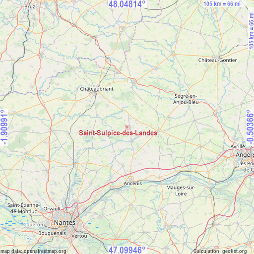
Saint-Sulpice-des-Landes GPS coordinates[2]
47° 34' 33.42" North, 1° 12' 24.408" West
| Map corner | latitude | longitude |
|---|---|---|
| Upper-left | 48.04814°, | -1.90991° |
| Center: | 47.57595°, | -1.20678° |
| Lower-right: | 47.09946°, | -0.50366° |
| Map W x H: | 105.5×105.5 km | = 65.6×65.6mi |
| max Lat: | 51.07786° ⇑47.7% North |
| Saint-Sulpice-des-Landes: | 47.57595° |
| min Lat: | ⇓52.3% South 41.3874° |
| min Long | Saint-Sulpice-d | max Long |
| -5.08615° | -1.20678° | 9.52242° |
| W 10%⇐ | ⇒90% E |
Elevation
Elevation of Saint-Sulpice-des-Landes is 73 m = 240 ft, and this is 120.7 m = 396 ft below average elevation for this country.
| Max E: |
2333 m = 7654 ft | 72.3% |
| Avg. | 193.7 m = 635 ft | |
| Saint-Sulpice-des-Landes | 73 m = 240 ft | |
Min E: |
-1 m = -3 ft | 27.7% |
See also: France elevation on elevation.city.
Geographical zone
Saint-Sulpice-des-Landes is located in North temperate zone (between Tropic of Cancer and the Arctic Circle). Distance of this North polar circle is 2111.2 km =1311.8 mi to North.| Distance of | km | miles | from Saint-Sulpice-des-Landes |
|---|---|---|---|
| North Pole | 4717.1 | 2931.1 | to North |
| Arctic Circle | 2111.2 | 1311.8 | to North |
| Tropic Cancer | 2684 | 1667.8 | to South |
| Equator | 5289.9 | 3287 | to South |


Nearby cities:
15 places around Saint-Sulpice-des-Landes: (largest is in red/bold)
• Bonnœuvre
5.1 km =3.2 mi,  202°
202°
• Candé
12.9 km =8 mi,  97°
97°
• Challain-la-Potherie
13.7 km =8.5 mi,  60°
60°
• Erbray
12.1 km =7.5 mi,  316°
316°
• Freigné
7 km =4.3 mi,  115°
115°
• La Chapelle-Glain
5.2 km =3.2 mi,  9°
9°
• Maumusson
12.9 km =8 mi,  143°
143°
• Moisdon-la-Rivière
13.4 km =8.3 mi,  292°
292°
• Pannecé
10.3 km =6.4 mi,  193°
193°
• Pouillé-les-Côteaux
13.8 km =8.6 mi,  165°
165°
• Riaillé
9.2 km =5.7 mi,  225°
225°
• Saint-Julien-de-Vouvantes
7.8 km =4.8 mi,  341°
341°
• Saint-Mars-la-Jaille
5.8 km =3.6 mi,  163°
163°
• Teillé
13.8 km =8.6 mi, 202°
• Vritz
10.3 km =6.4 mi,  86°
86°
Sources, notices
• [Note1] Compared only with cities in France existing in our database
• [Src1] Map data: © OpenStreetMap contributors (CC-BY-SA)
• [Src2] Other city data from geonames.org with taken over terms of usage.
• [Src3] Geographical zone / Annual Mean Temperature by Robert A. Rohde @ Wikipedia
