La Chapelle-Glain geodata
La Chapelle-Glain (Pays de la Loire) is a populated place; located in France in Europe/Paris (GMT+2) time zone. With population of 824 people, there are 10351 cities with bigger population in this country. Compared to other cities in France, 53% of cities are located further ↓South; 90% of cities are located further →East and 76.2% of cities have higher elevation than La Chapelle-Glain. Note1
Administrative division(s):
- Level 1: Pays de la Loire
- Level 2: Loire-Atlantique
- Level 3: Arrondissement of Châteaubriant-Ancenis
- Level 4: La Chapelle-Glain


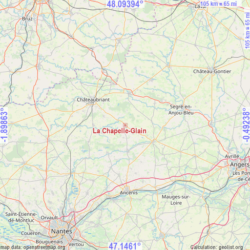
La Chapelle-Glain GPS coordinates[2]
47° 37' 19.812" North, 1° 11' 43.8" West
| Map corner | latitude | longitude |
|---|---|---|
| Upper-left | 48.09394°, | -1.89863° |
| Center: | 47.62217°, | -1.1955° |
| Lower-right: | 47.1461°, | -0.49238° |
| Map W x H: | 105.4×105.4 km | = 65.5×65.5mi |
| max Lat: | 51.07786° ⇑47% North |
| La Chapelle-Glain: | 47.62217° |
| min Lat: | ⇓53% South 41.3874° |
| min Long | La Chapelle-Gla | max Long |
| -5.08615° | -1.1955° | 9.52242° |
| W 10%⇐ | ⇒90% E |
Elevation
Elevation of La Chapelle-Glain is 64 m = 210 ft, and this is 129.7 m = 426 ft below average elevation for this country.
| Max E: |
2333 m = 7654 ft | 76.2% |
| Avg. | 193.7 m = 635 ft | |
| La Chapelle-Glain | 64 m = 210 ft | |
Min E: |
-1 m = -3 ft | 23.8% |
See also: France elevation on elevation.city.
Geographical zone
La Chapelle-Glain is located in North temperate zone (between Tropic of Cancer and the Arctic Circle). Distance of this North polar circle is 2106.1 km =1308.7 mi to North.| Distance of | km | miles | from La Chapelle-Glain |
|---|---|---|---|
| North Pole | 4712 | 2927.9 | to North |
| Arctic Circle | 2106.1 | 1308.7 | to North |
| Tropic Cancer | 2689.2 | 1671 | to South |
| Equator | 5295.1 | 3290.2 | to South |


Nearby cities:
15 places around La Chapelle-Glain: (largest is in red/bold)
• Bonnœuvre
10.3 km =6.4 mi,  196°
196°
• Candé
13.7 km =8.5 mi,  119°
119°
• Challain-la-Potherie
11.2 km =7 mi,  81°
81°
• Combrée
15.4 km =9.6 mi,  53°
53°
• Erbray
9.9 km =6.2 mi,  291°
291°
• Freigné
9.8 km =6.1 mi,  146°
146°
• Moisdon-la-Rivière
13.3 km =8.3 mi,  269°
269°
• Pannecé
15.5 km =9.6 mi,  192°
192°
• Pouancé
13.4 km =8.3 mi,  7°
7°
• Riaillé
13.7 km =8.5 mi,  212°
212°
• Saint-Julien-de-Vouvantes
4 km =2.5 mi,  303°
303°
• Saint-Mars-la-Jaille
10.8 km =6.7 mi,  175°
175°
• Saint-Sulpice-des-Landes
5.2 km =3.2 mi, 189°
• Soudan
15.3 km =9.5 mi,  327°
327°
• Vritz
10.4 km =6.5 mi, 115°
Sources, notices
• [Note1] Compared only with cities in France existing in our database
• [Src1] Map data: © OpenStreetMap contributors (CC-BY-SA)
• [Src2] Other city data from geonames.org with taken over terms of usage.
• [Src3] Geographical zone / Annual Mean Temperature by Robert A. Rohde @ Wikipedia
