Saint-Suliac geodata
Saint-Suliac (Brittany) is a populated place; located in France in Europe/Paris (GMT+2) time zone. With population of 940 people, there are 9303 cities with bigger population in this country. Compared to other cities in France, 70.1% of cities are located further ↓South; 94.8% of cities are located further →East and 92.7% of cities have higher elevation than Saint-Suliac. Note1
Administrative division(s):
- Level 1: Brittany
- Level 2: Département d'Ille-et-Vilaine
- Level 3: Arrondissement de Saint-Malo
- Level 4: Saint-Suliac


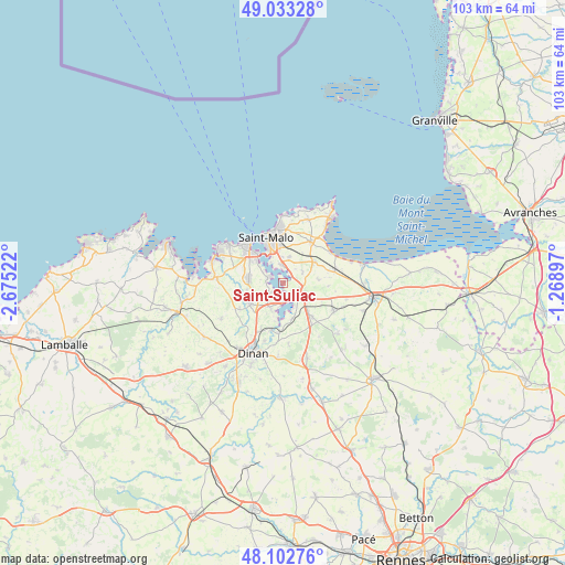
Saint-Suliac GPS coordinates[2]
48° 34' 12.576" North, 1° 58' 19.524" West
| Map corner | latitude | longitude |
|---|---|---|
| Upper-left | 49.03328°, | -2.67522° |
| Center: | 48.57016°, | -1.97209° |
| Lower-right: | 48.10276°, | -1.26897° |
| Map W x H: | 103.5×103.5 km | = 64.3×64.3mi |
| max Lat: | 51.07786° ⇑29.9% North |
| Saint-Suliac: | 48.57016° |
| min Lat: | ⇓70.1% South 41.3874° |
| min Long | Saint-Suliac | max Long |
| -5.08615° | -1.97209° | 9.52242° |
| W 5.2%⇐ | ⇒94.8% E |
Elevation
Elevation of Saint-Suliac is 23 m = 75 ft, and this is 170.7 m = 560 ft below average elevation for this country.
| Max E: |
2333 m = 7654 ft | 92.7% |
| Avg. | 193.7 m = 635 ft | |
| Saint-Suliac | 23 m = 75 ft | |
Min E: |
-1 m = -3 ft | 7.3% |
See also: France elevation on elevation.city.
Geographical zone
Saint-Suliac is located in North temperate zone (between Tropic of Cancer and the Arctic Circle). Distance of this North polar circle is 2000.7 km =1243.2 mi to North.| Distance of | km | miles | from Saint-Suliac |
|---|---|---|---|
| North Pole | 4606.6 | 2862.4 | to North |
| Arctic Circle | 2000.7 | 1243.2 | to North |
| Tropic Cancer | 2794.6 | 1736.5 | to South |
| Equator | 5400.5 | 3355.7 | to South |


Nearby cities:
15 places around Saint-Suliac: (largest is in red/bold)
• Châteauneuf-d’Ille-et-Vilaine
3.4 km =2.1 mi,  107°
107°
• La Gouesnière
6.9 km =4.3 mi,  56°
56°
• La Richardais
6.2 km =3.9 mi,  310°
310°
• La Ville-ès-Nonais
2.9 km =1.8 mi,  149°
149°
• Langrolay-sur-Rance
3 km =1.9 mi,  222°
222°
• Le Minihic-sur-Rance
2.8 km =1.7 mi,  288°
288°
• Miniac-Morvan
8.2 km =5.1 mi,  139°
139°
• Pleslin-Trigavou
8.1 km =5 mi,  239°
239°
• Pleudihen-sur-Rance
6 km =3.7 mi,  176°
176°
• Pleurtuit
6.4 km =4 mi,  278°
278°
• Plouër-sur-Rance
5.3 km =3.3 mi,  205°
205°
• Saint-Guinoux
6.5 km =4 mi,  84°
84°
• Saint-Jouan-des-Guérets
3.2 km =2 mi,  357°
357°
• Saint-Père
4 km =2.5 mi, 61°
• Tréméreuc
6.9 km =4.3 mi,  259°
259°
Sources, notices
• [Note1] Compared only with cities in France existing in our database
• [Src1] Map data: © OpenStreetMap contributors (CC-BY-SA)
• [Src2] Other city data from geonames.org with taken over terms of usage.
• [Src3] Geographical zone / Annual Mean Temperature by Robert A. Rohde @ Wikipedia
