Châteauneuf-d’Ille-et-Vilaine geodata
Châteauneuf-d’Ille-et-Vilaine (Brittany) is a populated place; located in France in Europe/Paris (GMT+2) time zone. With population of 1,187 people, there are 7613 cities with bigger population in this country. Compared to other cities in France, 69.8% of cities are located further ↓South; 94.6% of cities are located further →East and 98.2% of cities have higher elevation than Châteauneuf-d’Ille-et-Vilaine. Note1
Administrative division(s):
- Level 1: Brittany
- Level 2: Département d'Ille-et-Vilaine
- Level 3: Arrondissement de Saint-Malo
- Level 4: Châteauneuf-d'Ille-et-Vilaine
Current local time in Châteauneuf-d’Ille-et-Vilaine:
01:46 PM, MondayDifference from your time zone: hours


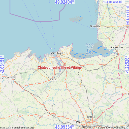
Châteauneuf-d’Ille-et-Vilaine GPS coordinates[2]
48° 33' 38.988" North, 1° 55' 42.168" West
| Map corner | latitude | longitude |
|---|---|---|
| Upper-left | 49.02404°, | -2.63151° |
| Center: | 48.56083°, | -1.92838° |
| Lower-right: | 48.09334°, | -1.22526° |
| Map W x H: | 103.5×103.5 km | = 64.3×64.3mi |
| max Lat: | 51.07786° ⇑30.2% North |
| Châteauneuf-d’Ille-et-Vilaine: | 48.56083° |
| min Lat: | ⇓69.8% South 41.3874° |
| min Long | Châteauneuf-d� | max Long |
| -5.08615° | -1.92838° | 9.52242° |
| W 5.4%⇐ | ⇒94.6% E |
Elevation
Elevation of Châteauneuf-d’Ille-et-Vilaine is 8 m = 26 ft, and this is 185.7 m = 609 ft below average elevation for this country.
| Max E: |
2333 m = 7654 ft | 98.2% |
| Avg. | 193.7 m = 635 ft | |
| Châteauneuf-d’Ille-et-Vilaine | 8 m = 26 ft | |
Min E: |
-1 m = -3 ft | 1.8% |
See also: France elevation on elevation.city.
Geographical zone
Châteauneuf-d’Ille-et-Vilaine is located in North temperate zone (between Tropic of Cancer and the Arctic Circle). Distance of this North polar circle is 2001.7 km =1243.8 mi to North.| Distance of | km | miles | from Châteauneuf-d’Ille-et-Vilaine |
|---|---|---|---|
| North Pole | 4607.6 | 2863 | to North |
| Arctic Circle | 2001.7 | 1243.8 | to North |
| Tropic Cancer | 2793.5 | 1735.8 | to South |
| Equator | 5399.5 | 3355.1 | to South |


Nearby cities:
15 places around Châteauneuf-d’Ille-et-Vilaine: (largest is in red/bold)
• La Fresnais
7.4 km =4.6 mi,  59°
59°
• La Gouesnière
5.5 km =3.4 mi,  27°
27°
• La Ville-ès-Nonais
2.3 km =1.4 mi,  230°
230°
• Langrolay-sur-Rance
5.4 km =3.4 mi,  257°
257°
• Le Minihic-sur-Rance
6.2 km =3.9 mi,  288°
288°
• Miniac-Morvan
5.5 km =3.4 mi,  157°
157°
• Plerguer
7 km =4.3 mi,  122°
122°
• Pleudihen-sur-Rance
5.7 km =3.5 mi,  209°
209°
• Plouër-sur-Rance
6.7 km =4.2 mi,  235°
235°
• Roz-Landrieux
8.5 km =5.3 mi,  103°
103°
• Saint-Benoît-des-Ondes
8.5 km =5.3 mi,  42°
42°
• Saint-Guinoux
3.7 km =2.3 mi, 63°
• Saint-Jouan-des-Guérets
5.4 km =3.4 mi,  322°
322°
• Saint-Père
3 km =1.9 mi,  6°
6°
• Saint-Suliac
3.4 km =2.1 mi, 287°
Sources, notices
• [Note1] Compared only with cities in France existing in our database
• [Src1] Map data: © OpenStreetMap contributors (CC-BY-SA)
• [Src2] Other city data from geonames.org with taken over terms of usage.
• [Src3] Geographical zone / Annual Mean Temperature by Robert A. Rohde @ Wikipedia
