Saint-Sornin-Lavolps geodata
Saint-Sornin-Lavolps (Nouvelle-Aquitaine) is a populated place; located in France in Europe/Paris (GMT+2) time zone. With population of 988 people, there are 8924 cities with bigger population in this country. Compared to other cities in France, 75.5% of cities are located further ↑North; 64.5% of cities are located further →East and 87.7% of cities have lower elevation than Saint-Sornin-Lavolps. Note1
Administrative division(s):
- Level 1: Nouvelle-Aquitaine
- Level 2: Département de la Corrèze
- Level 3: Arrondissement de Brive-la-Gaillarde
- Level 4: Saint-Sornin-Lavolps


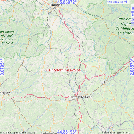
Saint-Sornin-Lavolps GPS coordinates[2]
45° 22' 40.728" North, 1° 22' 57.612" East
| Map corner | latitude | longitude |
|---|---|---|
| Upper-left | 45.86972°, | 0.67954° |
| Center: | 45.37798°, | 1.38267° |
| Lower-right: | 44.88193°, | 2.08579° |
| Map W x H: | 109.8×109.8 km | = 68.2×68.2mi |
| max Lat: | 51.07786° ⇑75.5% North |
| Saint-Sornin-Lavolps: | 45.37798° |
| min Lat: | ⇓24.5% South 41.3874° |
| min Long | Saint-Sornin-La | max Long |
| -5.08615° | 1.38267° | 9.52242° |
| W 35.5%⇐ | ⇒64.5% E |
Elevation
Elevation of Saint-Sornin-Lavolps is 384 m = 1260 ft, and this is 190.3 m = 624 ft above average elevation for this country.
| Max E: |
2333 m = 7654 ft | 12.3% |
| Saint-Sornin-Lavolps | 384 m 1260 ft | |
| Avg. | 193.7 m = 635 ft | |
Min E: |
-1 m = -3 ft | 87.7% |
See also: France elevation on elevation.city.
Geographical zone
Saint-Sornin-Lavolps is located in North temperate zone (between Tropic of Cancer and the Arctic Circle). Distance of this North polar circle is 2355.6 km =1463.7 mi to North.| Distance of | km | miles | from Saint-Sornin-Lavolps |
|---|---|---|---|
| North Pole | 4961.5 | 3082.9 | to North |
| Arctic Circle | 2355.6 | 1463.7 | to North |
| Tropic Cancer | 2439.6 | 1515.9 | to South |
| Equator | 5045.6 | 3135.2 | to South |


Nearby cities:
15 places around Saint-Sornin-Lavolps: (largest is in red/bold)
• Allassac
15.1 km =9.4 mi,  151°
151°
• Arnac-Pompadour
3.7 km =2.3 mi,  344°
344°
• Beyssac
1.8 km =1.1 mi,  114°
114°
• Juillac
8.1 km =5 mi,  215°
215°
• Lubersac
7.6 km =4.7 mi,  12°
12°
• Objat
12.9 km =8 mi,  171°
171°
• Payzac
13.2 km =8.2 mi,  280°
280°
• Perpezac-le-Noir
14.5 km =9 mi, 113°
• Saint-Ybard
13.3 km =8.3 mi,  54°
54°
• Savignac-Lédrier
12.8 km =8 mi,  262°
262°
• Troche
4.7 km =2.9 mi,  76°
76°
• Uzerche
15 km =9.3 mi,  69°
69°
• Vigeois
10.5 km =6.5 mi,  89°
89°
• Vignols
6.5 km =4 mi,  175°
175°
• Voutezac
10.5 km =6.5 mi,  155°
155°
Sources, notices
• [Note1] Compared only with cities in France existing in our database
• [Src1] Map data: © OpenStreetMap contributors (CC-BY-SA)
• [Src2] Other city data from geonames.org with taken over terms of usage.
• [Src3] Geographical zone / Annual Mean Temperature by Robert A. Rohde @ Wikipedia
