Saint-Siméon geodata
Saint-Siméon (Île-de-France) is a populated place; located in France in Europe/Paris (GMT+2) time zone. With population of 809 people, there are 10494 cities with bigger population in this country. Compared to other cities in France, 75.5% of cities are located further ↓South; 60.7% of cities are located further ←West and 59.7% of cities have higher elevation than Saint-Siméon. Note1
Administrative division(s):
- Level 1: Île-de-France
- Level 2: Seine-et-Marne
- Level 3: Arrondissement de Provins
- Level 4: Saint-Siméon


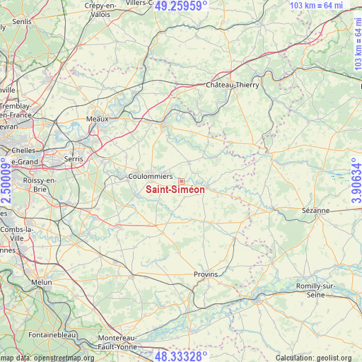
Saint-Siméon GPS coordinates[2]
48° 47' 54.852" North, 3° 12' 11.556" East
| Map corner | latitude | longitude |
|---|---|---|
| Upper-left | 49.25959°, | 2.50009° |
| Center: | 48.79857°, | 3.20321° |
| Lower-right: | 48.33328°, | 3.90634° |
| Map W x H: | 103×103 km | = 64×64mi |
| max Lat: | 51.07786° ⇑24.5% North |
| Saint-Siméon: | 48.79857° |
| min Lat: | ⇓75.5% South 41.3874° |
| min Long | Saint-Siméon | max Long |
| -5.08615° | 3.20321° | 9.52242° |
| W 60.7%⇐ | ⇒39.3% E |
Elevation
Elevation of Saint-Siméon is 103 m = 338 ft, and this is 90.7 m = 298 ft below average elevation for this country.
| Max E: |
2333 m = 7654 ft | 59.7% |
| Avg. | 193.7 m = 635 ft | |
| Saint-Siméon | 103 m = 338 ft | |
Min E: |
-1 m = -3 ft | 40.3% |
See also: France elevation on elevation.city.
Geographical zone
Saint-Siméon is located in North temperate zone (between Tropic of Cancer and the Arctic Circle). Distance of this North polar circle is 1975.3 km =1227.4 mi to North.| Distance of | km | miles | from Saint-Siméon |
|---|---|---|---|
| North Pole | 4581.2 | 2846.6 | to North |
| Arctic Circle | 1975.3 | 1227.4 | to North |
| Tropic Cancer | 2820 | 1752.3 | to South |
| Equator | 5425.9 | 3371.5 | to South |


Nearby cities:
15 places around Saint-Siméon: (largest is in red/bold)
• Amillis
8.4 km =5.2 mi,  220°
220°
• Beautheil
9.4 km =5.8 mi,  245°
245°
• Boissy-le-Châtel
5.5 km =3.4 mi,  296°
296°
• Chailly-en-Brie
5.8 km =3.6 mi,  260°
260°
• Chauffry
2.1 km =1.3 mi,  311°
311°
• Chevru
6.9 km =4.3 mi,  184°
184°
• Choisy-en-Brie
4.6 km =2.9 mi,  167°
167°
• Coulommiers
8.8 km =5.5 mi,  281°
281°
• Doue
8.1 km =5 mi,  338°
338°
• Jouy-sur-Morin
5.1 km =3.2 mi,  94°
94°
• La Ferté-Gaucher
7.8 km =4.8 mi,  102°
102°
• Rebais
5.8 km =3.6 mi,  21°
21°
• Saint-Denis-lès-Rebais
4.1 km =2.5 mi,  7°
7°
• Saint-Martin-des-Champs
9.9 km =6.2 mi, 103°
• Saint-Rémy-la-Vanne
2.3 km =1.4 mi,  109°
109°
Sources, notices
• [Note1] Compared only with cities in France existing in our database
• [Src1] Map data: © OpenStreetMap contributors (CC-BY-SA)
• [Src2] Other city data from geonames.org with taken over terms of usage.
• [Src3] Geographical zone / Annual Mean Temperature by Robert A. Rohde @ Wikipedia
