Saint-Sever-de-Saintonge geodata
Saint-Sever-de-Saintonge (Nouvelle-Aquitaine) is a populated place; located in France in Europe/Paris (GMT+2) time zone. With population of 627 people, there are 12867 cities with bigger population in this country. Compared to other cities in France, 70.9% of cities are located further ↑North; 83.4% of cities are located further →East and 99.6% of cities have higher elevation than Saint-Sever-de-Saintonge. Note1
Administrative division(s):
- Level 1: Nouvelle-Aquitaine
- Level 2: Charente-Maritime
- Level 3: Arrondissement de Saintes
- Level 4: Saint-Sever-de-Saintonge
Current local time in Saint-Sever-de-Saintonge:
03:41 PM, SaturdayDifference from your time zone: hours


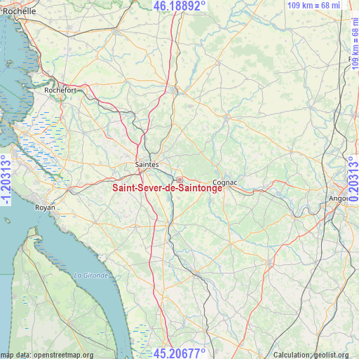
Saint-Sever-de-Saintonge GPS coordinates[2]
45° 42' 0" North, 0° 30' 0" West
| Map corner | latitude | longitude |
|---|---|---|
| Upper-left | 46.18892°, | -1.20313° |
| Center: | 45.7°, | -0.5° |
| Lower-right: | 45.20677°, | 0.20313° |
| Map W x H: | 109.2×109.2 km | = 67.9×67.9mi |
| max Lat: | 51.07786° ⇑70.9% North |
| Saint-Sever-de-Saintonge: | 45.7° |
| min Lat: | ⇓29.1% South 41.3874° |
| min Long | Saint-Sever-de- | max Long |
| -5.08615° | -0.5° | 9.52242° |
| W 16.6%⇐ | ⇒83.4% E |
Elevation
Elevation of Saint-Sever-de-Saintonge is 4 m = 13 ft, and this is 189.7 m = 622 ft below average elevation for this country.
| Max E: |
2333 m = 7654 ft | 99.6% |
| Avg. | 193.7 m = 635 ft | |
| Saint-Sever-de-Saintonge | 4 m = 13 ft | |
Min E: |
-1 m = -3 ft | 0.4% |
See also: France elevation on elevation.city.
Geographical zone
Saint-Sever-de-Saintonge is located in North temperate zone (between Tropic of Cancer and the Arctic Circle). Distance of this North polar circle is 2319.8 km =1441.5 mi to North.| Distance of | km | miles | from Saint-Sever-de-Saintonge |
|---|---|---|---|
| North Pole | 4925.7 | 3060.7 | to North |
| Arctic Circle | 2319.8 | 1441.5 | to North |
| Tropic Cancer | 2475.4 | 1538.1 | to South |
| Equator | 5081.4 | 3157.4 | to South |


Nearby cities:
15 places around Saint-Sever-de-Saintonge: (largest is in red/bold)
• Ars
11.1 km =6.9 mi,  124°
124°
• Burie
10.1 km =6.3 mi,  36°
36°
• Chaniers
4.9 km =3 mi,  294°
294°
• Chérac
4.8 km =3 mi,  83°
83°
• Courcoury
6.3 km =3.9 mi,  282°
282°
• Fontcouverte
10.1 km =6.3 mi,  317°
317°
• La Chapelle-des-Pots
7.4 km =4.6 mi,  334°
334°
• Les Gonds
9 km =5.6 mi, 280°
• Merpins
8 km =5 mi,  103°
103°
• Montils
5.7 km =3.5 mi,  181°
181°
• Pérignac
9 km =5.6 mi,  162°
162°
• Saint-Laurent-de-Cognac
7.1 km =4.4 mi,  92°
92°
• Saint-Léger
10.9 km =6.8 mi,  216°
216°
• Saint-Sauvant
4.3 km =2.7 mi,  355°
355°
• Salignac-sur-Charente
6.3 km =3.9 mi, 119°
Sources, notices
• [Note1] Compared only with cities in France existing in our database
• [Src1] Map data: © OpenStreetMap contributors (CC-BY-SA)
• [Src2] Other city data from geonames.org with taken over terms of usage.
• [Src3] Geographical zone / Annual Mean Temperature by Robert A. Rohde @ Wikipedia
