Saint-Romain-les-Atheux geodata
Saint-Romain-les-Atheux (Auvergne-Rhône-Alpes) is a populated place; located in France in Europe/Paris (GMT+2) time zone. With population of 823 people, there are 10361 cities with bigger population in this country. Compared to other cities in France, 75.6% of cities are located further ↑North; 71.2% of cities are located further ←West and 98.7% of cities have lower elevation than Saint-Romain-les-Atheux. Note1
Administrative division(s):
- Level 1: Auvergne-Rhône-Alpes
- Level 2: Département de la Loire
- Level 3: Arrondissement de Saint-Étienne
- Level 4: Saint-Romain-les-Atheux
Current local time in Saint-Romain-les-Atheux:
09:58 AM, SaturdayDifference from your time zone: hours


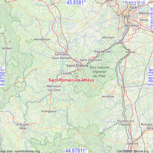
Saint-Romain-les-Atheux GPS coordinates[2]
45° 21' 58.536" North, 4° 22' 41.268" East
| Map corner | latitude | longitude |
|---|---|---|
| Upper-left | 45.8581°, | 3.67501° |
| Center: | 45.36626°, | 4.37813° |
| Lower-right: | 44.87011°, | 5.08126° |
| Map W x H: | 109.9×109.9 km | = 68.3×68.3mi |
| max Lat: | 51.07786° ⇑75.6% North |
| Saint-Romain-les-Atheux: | 45.36626° |
| min Lat: | ⇓24.4% South 41.3874° |
| min Long | Saint-Romain-le | max Long |
| -5.08615° | 4.37813° | 9.52242° |
| W 71.2%⇐ | ⇒28.8% E |
Elevation
Elevation of Saint-Romain-les-Atheux is 912 m = 2992 ft, and this is 718.3 m = 2357 ft above average elevation for this country.
| Max E: |
2333 m = 7654 ft | 1.3% |
| Saint-Romain-les-Atheux | 912 m 2992 ft | |
| Avg. | 193.7 m = 635 ft | |
Min E: |
-1 m = -3 ft | 98.7% |
See also: France elevation on elevation.city.
Geographical zone
Saint-Romain-les-Atheux is located in North temperate zone (between Tropic of Cancer and the Arctic Circle). Distance of this North polar circle is 2356.9 km =1464.5 mi to North.| Distance of | km | miles | from Saint-Romain-les-Atheux |
|---|---|---|---|
| North Pole | 4962.8 | 3083.7 | to North |
| Arctic Circle | 2356.9 | 1464.5 | to North |
| Tropic Cancer | 2438.3 | 1515.1 | to South |
| Equator | 5044.3 | 3134.4 | to South |


Nearby cities:
15 places around Saint-Romain-les-Atheux: (largest is in red/bold)
• Firminy
7.5 km =4.7 mi,  290°
290°
• Fraisses
9.3 km =5.8 mi, 285°
• Jonzieux
6 km =3.7 mi,  192°
192°
• La Ricamarie
4.4 km =2.7 mi,  351°
351°
• Le Chambon-Feugerolles
5.2 km =3.2 mi,  302°
302°
• Marlhes
9.4 km =5.8 mi,  171°
171°
• Planfoy
5.3 km =3.3 mi,  69°
69°
• Roche-la-Molière
8.2 km =5.1 mi,  331°
331°
• Saint-Didier-en-Velay
10.7 km =6.6 mi,  228°
228°
• Saint-Genest-Lerpt
9.1 km =5.7 mi,  340°
340°
• Saint-Genest-Malifaux
4.1 km =2.5 mi,  133°
133°
• Saint-Just-Malmont
5.9 km =3.7 mi,  239°
239°
• Saint-Victor-Malescours
9.8 km =6.1 mi,  211°
211°
• Saint-Étienne
7.6 km =4.7 mi,  7°
7°
• Unieux
9.4 km =5.8 mi, 296°
Sources, notices
• [Note1] Compared only with cities in France existing in our database
• [Src1] Map data: © OpenStreetMap contributors (CC-BY-SA)
• [Src2] Other city data from geonames.org with taken over terms of usage.
• [Src3] Geographical zone / Annual Mean Temperature by Robert A. Rohde @ Wikipedia
