Saint-Just-Malmont geodata
Saint-Just-Malmont (Auvergne-Rhône-Alpes) is a populated place; located in France in Europe/Paris (GMT+2) time zone. With population of 4,132 people, there are 2375 cities with bigger population in this country. Compared to other cities in France, 75.9% of cities are located further ↑North; 70.7% of cities are located further ←West and 98.1% of cities have lower elevation than Saint-Just-Malmont. Note1
Administrative division(s):
- Level 1: Auvergne-Rhône-Alpes
- Level 2: Haute-Loire
- Level 3: Yssingeaux
- Level 4: Saint-Just-Malmont


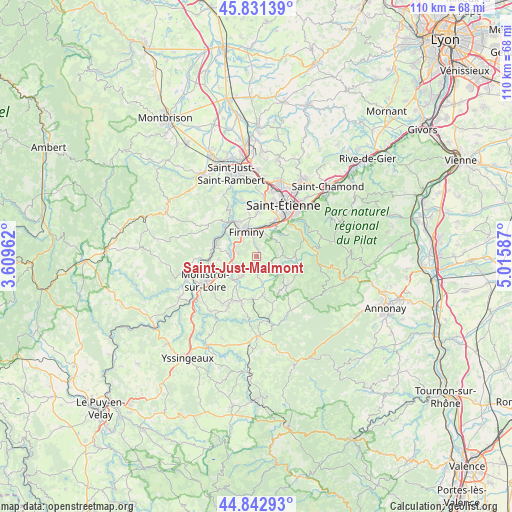
Saint-Just-Malmont GPS coordinates[2]
45° 20' 21.552" North, 4° 18' 45.9" East
| Map corner | latitude | longitude |
|---|---|---|
| Upper-left | 45.83139°, | 3.60962° |
| Center: | 45.33932°, | 4.31275° |
| Lower-right: | 44.84293°, | 5.01587° |
| Map W x H: | 109.9×109.9 km | = 68.3×68.3mi |
| max Lat: | 51.07786° ⇑75.9% North |
| Saint-Just-Malmont: | 45.33932° |
| min Lat: | ⇓24.1% South 41.3874° |
| min Long | Saint-Just-Malm | max Long |
| -5.08615° | 4.31275° | 9.52242° |
| W 70.7%⇐ | ⇒29.3% E |
Elevation
Elevation of Saint-Just-Malmont is 839 m = 2753 ft, and this is 645.3 m = 2117 ft above average elevation for this country.
| Max E: |
2333 m = 7654 ft | 1.9% |
| Saint-Just-Malmont | 839 m 2753 ft | |
| Avg. | 193.7 m = 635 ft | |
Min E: |
-1 m = -3 ft | 98.1% |
See also: France elevation on elevation.city.
Geographical zone
Saint-Just-Malmont is located in North temperate zone (between Tropic of Cancer and the Arctic Circle). Distance of this North polar circle is 2359.9 km =1466.4 mi to North.| Distance of | km | miles | from Saint-Just-Malmont |
|---|---|---|---|
| North Pole | 4965.8 | 3085.6 | to North |
| Arctic Circle | 2359.9 | 1466.4 | to North |
| Tropic Cancer | 2435.3 | 1513.2 | to South |
| Equator | 5041.3 | 3132.5 | to South |


Nearby cities:
15 places around Saint-Just-Malmont: (largest is in red/bold)
• Aurec-sur-Loire
9.3 km =5.8 mi,  290°
290°
• Firminy
5.9 km =3.7 mi,  341°
341°
• Fraisses
6.7 km =4.2 mi,  324°
324°
• Jonzieux
4.8 km =3 mi,  126°
126°
• La Ricamarie
8.6 km =5.3 mi,  31°
31°
• La Séauve-sur-Semène
6.9 km =4.3 mi,  225°
225°
• Le Chambon-Feugerolles
5.8 km =3.6 mi,  6°
6°
• Marlhes
9 km =5.6 mi, 133°
• Pont-Salomon
5.1 km =3.2 mi,  268°
268°
• Saint-Didier-en-Velay
5 km =3.1 mi,  215°
215°
• Saint-Genest-Malifaux
8.1 km =5 mi,  88°
88°
• Saint-Romain-Lachalm
8.3 km =5.2 mi,  168°
168°
• Saint-Romain-les-Atheux
5.9 km =3.7 mi,  59°
59°
• Saint-Victor-Malescours
5.3 km =3.3 mi,  180°
180°
• Unieux
7.9 km =4.9 mi, 335°
Sources, notices
• [Note1] Compared only with cities in France existing in our database
• [Src1] Map data: © OpenStreetMap contributors (CC-BY-SA)
• [Src2] Other city data from geonames.org with taken over terms of usage.
• [Src3] Geographical zone / Annual Mean Temperature by Robert A. Rohde @ Wikipedia
