Saint-Roch geodata
Saint-Roch (Centre) is a populated place; located in France in Europe/Paris (GMT+2) time zone. With population of 914 people, there are 9537 cities with bigger population in this country. Compared to other cities in France, 50.4% of cities are located further ↓South; 72.6% of cities are located further →East and 65.3% of cities have higher elevation than Saint-Roch. Note1
Administrative division(s):
- Level 1: Centre
- Level 2: Département d'Indre-et-Loire
- Level 3: Arrondissement de Chinon
- Level 4: Saint-Roch


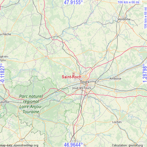
Saint-Roch GPS coordinates[2]
47° 26' 31.56" North, 0° 35' 5.496" East
| Map corner | latitude | longitude |
|---|---|---|
| Upper-left | 47.9155°, | -0.11827° |
| Center: | 47.4421°, | 0.58486° |
| Lower-right: | 46.9644°, | 1.28798° |
| Map W x H: | 105.8×105.8 km | = 65.7×65.7mi |
| max Lat: | 51.07786° ⇑49.6% North |
| Saint-Roch: | 47.4421° |
| min Lat: | ⇓50.4% South 41.3874° |
| min Long | Saint-Roch | max Long |
| -5.08615° | 0.58486° | 9.52242° |
| W 27.4%⇐ | ⇒72.6% E |
Elevation
Elevation of Saint-Roch is 89 m = 292 ft, and this is 104.7 m = 344 ft below average elevation for this country.
| Max E: |
2333 m = 7654 ft | 65.3% |
| Avg. | 193.7 m = 635 ft | |
| Saint-Roch | 89 m = 292 ft | |
Min E: |
-1 m = -3 ft | 34.7% |
See also: France elevation on elevation.city.
Geographical zone
Saint-Roch is located in North temperate zone (between Tropic of Cancer and the Arctic Circle). Distance of this North polar circle is 2126.1 km =1321.1 mi to North.| Distance of | km | miles | from Saint-Roch |
|---|---|---|---|
| North Pole | 4732 | 2940.3 | to North |
| Arctic Circle | 2126.1 | 1321.1 | to North |
| Tropic Cancer | 2669.1 | 1658.5 | to South |
| Equator | 5275.1 | 3277.8 | to South |


Nearby cities:
15 places around Saint-Roch: (largest is in red/bold)
• Berthenay
9.8 km =6.1 mi,  207°
207°
• Chanceaux-sur-Choisille
9.6 km =6 mi,  70°
70°
• Charentilly
3.6 km =2.2 mi,  30°
30°
• Fondettes
4.4 km =2.7 mi,  168°
168°
• La Membrolle-sur-Choisille
3.6 km =2.2 mi,  98°
98°
• La Riche
8.7 km =5.4 mi,  131°
131°
• Luynes
6.8 km =4.2 mi,  199°
199°
• Mettray
5 km =3.1 mi,  76°
76°
• Pernay
6.4 km =4 mi,  270°
270°
• Rouziers-de-Touraine
9.6 km =6 mi, 29°
• Saint-Antoine-du-Rocher
7 km =4.3 mi, 29°
• Saint-Cyr-sur-Loire
7.7 km =4.8 mi, 127°
• Saint-Genouph
7.2 km =4.5 mi, 171°
• Saint-Étienne-de-Chigny
7.6 km =4.7 mi, 210°
• Semblançay
6.4 km =4 mi,  358°
358°
Sources, notices
• [Note1] Compared only with cities in France existing in our database
• [Src1] Map data: © OpenStreetMap contributors (CC-BY-SA)
• [Src2] Other city data from geonames.org with taken over terms of usage.
• [Src3] Geographical zone / Annual Mean Temperature by Robert A. Rohde @ Wikipedia
