Rouziers-de-Touraine geodata
Rouziers-de-Touraine (Centre) is a populated place; located in France in Europe/Paris (GMT+2) time zone. With population of 1,084 people, there are 8234 cities with bigger population in this country. Compared to other cities in France, 51.5% of cities are located further ↓South; 71.9% of cities are located further →East and 53.3% of cities have higher elevation than Rouziers-de-Touraine. Note1
Administrative division(s):
- Level 1: Centre
- Level 2: Département d'Indre-et-Loire
- Level 3: Arrondissement de Chinon
- Level 4: Rouziers-de-Touraine


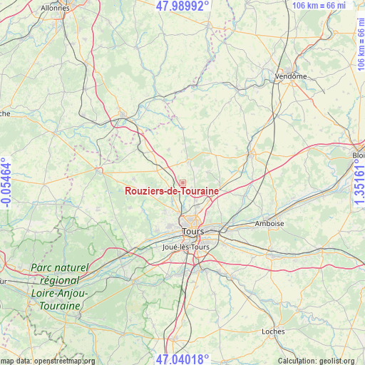
Rouziers-de-Touraine GPS coordinates[2]
47° 31' 1.92" North, 0° 38' 54.528" East
| Map corner | latitude | longitude |
|---|---|---|
| Upper-left | 47.98992°, | -0.05464° |
| Center: | 47.5172°, | 0.64848° |
| Lower-right: | 47.04018°, | 1.35161° |
| Map W x H: | 105.6×105.6 km | = 65.6×65.6mi |
| max Lat: | 51.07786° ⇑48.5% North |
| Rouziers-de-Touraine: | 47.5172° |
| min Lat: | ⇓51.5% South 41.3874° |
| min Long | Rouziers-de-Tou | max Long |
| -5.08615° | 0.64848° | 9.52242° |
| W 28.1%⇐ | ⇒71.9% E |
Elevation
Elevation of Rouziers-de-Touraine is 121 m = 397 ft, and this is 72.7 m = 239 ft below average elevation for this country.
| Max E: |
2333 m = 7654 ft | 53.3% |
| Avg. | 193.7 m = 635 ft | |
| Rouziers-de-Touraine | 121 m = 397 ft | |
Min E: |
-1 m = -3 ft | 46.7% |
See also: France elevation on elevation.city.
Geographical zone
Rouziers-de-Touraine is located in North temperate zone (between Tropic of Cancer and the Arctic Circle). Distance of this North polar circle is 2117.8 km =1315.9 mi to North.| Distance of | km | miles | from Rouziers-de-Touraine |
|---|---|---|---|
| North Pole | 4723.6 | 2935.1 | to North |
| Arctic Circle | 2117.8 | 1315.9 | to North |
| Tropic Cancer | 2677.5 | 1663.7 | to South |
| Equator | 5283.4 | 3283 | to South |


Nearby cities:
15 places around Rouziers-de-Touraine: (largest is in red/bold)
• Beaumont-la-Ronce
6 km =3.7 mi,  15°
15°
• Cerelles
3.1 km =1.9 mi,  123°
123°
• Chanceaux-sur-Choisille
6.6 km =4.1 mi,  139°
139°
• Charentilly
6 km =3.7 mi,  209°
209°
• La Membrolle-sur-Choisille
9 km =5.6 mi,  188°
188°
• Mettray
7.2 km =4.5 mi,  179°
179°
• Monnaie
10.7 km =6.6 mi,  99°
99°
• Neuillé-Pont-Pierre
8.2 km =5.1 mi,  295°
295°
• Neuvy-le-Roi
10.4 km =6.5 mi,  337°
337°
• Nouzilly
8 km =5 mi,  67°
67°
• Parçay-Meslay
11.2 km =7 mi, 138°
• Saint-Antoine-du-Rocher
2.7 km =1.7 mi, 211°
• Saint-Laurent-en-Gâtines
12.4 km =7.7 mi,  51°
51°
• Saint-Roch
9.6 km =6 mi, 209°
• Semblançay
5.3 km =3.3 mi,  248°
248°
Sources, notices
• [Note1] Compared only with cities in France existing in our database
• [Src1] Map data: © OpenStreetMap contributors (CC-BY-SA)
• [Src2] Other city data from geonames.org with taken over terms of usage.
• [Src3] Geographical zone / Annual Mean Temperature by Robert A. Rohde @ Wikipedia
