Saint-Étienne-de-Chigny geodata
Saint-Étienne-de-Chigny (Centre) is a populated place; located in France in Europe/Paris (GMT+2) time zone. With population of 1,382 people, there are 6675 cities with bigger population in this country. Compared to other cities in France, 50.4% of cities are located further ↑North; 73.1% of cities are located further →East and 77.3% of cities have higher elevation than Saint-Étienne-de-Chigny. Note1
Administrative division(s):
- Level 1: Centre
- Level 2: Département d'Indre-et-Loire
- Level 3: Arrondissement de Tours
- Level 4: Saint-Étienne-de-Chigny
Current local time in Saint-Étienne-de-Chigny:
11:32 AM, SaturdayDifference from your time zone: hours


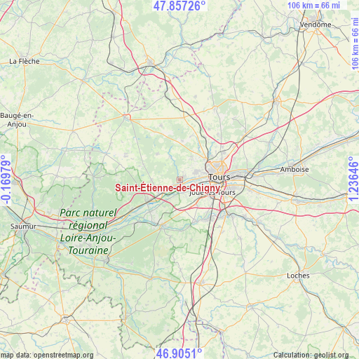
Saint-Étienne-de-Chigny GPS coordinates[2]
47° 22' 59.988" North, 0° 31' 59.988" East
| Map corner | latitude | longitude |
|---|---|---|
| Upper-left | 47.85726°, | -0.16979° |
| Center: | 47.38333°, | 0.53333° |
| Lower-right: | 46.9051°, | 1.23646° |
| Map W x H: | 105.9×105.9 km | = 65.8×65.8mi |
| max Lat: | 51.07786° ⇑50.4% North |
| Saint-Étienne-de-Chigny: | 47.38333° |
| min Lat: | ⇓49.6% South 41.3874° |
| min Long | Saint-Étienne- | max Long |
| -5.08615° | 0.53333° | 9.52242° |
| W 26.9%⇐ | ⇒73.1% E |
Elevation
Elevation of Saint-Étienne-de-Chigny is 61 m = 200 ft, and this is 132.7 m = 435 ft below average elevation for this country.
| Max E: |
2333 m = 7654 ft | 77.3% |
| Avg. | 193.7 m = 635 ft | |
| Saint-Étienne-de-Chigny | 61 m = 200 ft | |
Min E: |
-1 m = -3 ft | 22.7% |
See also: France elevation on elevation.city.
Geographical zone
Saint-Étienne-de-Chigny is located in North temperate zone (between Tropic of Cancer and the Arctic Circle). Distance of this North polar circle is 2132.6 km =1325.1 mi to North.| Distance of | km | miles | from Saint-Étienne-de-Chigny |
|---|---|---|---|
| North Pole | 4738.5 | 2944.4 | to North |
| Arctic Circle | 2132.6 | 1325.1 | to North |
| Tropic Cancer | 2662.6 | 1654.5 | to South |
| Equator | 5268.5 | 3273.7 | to South |


Nearby cities:
15 places around Saint-Étienne-de-Chigny: (largest is in red/bold)
• Ambillou
9.9 km =6.2 mi,  319°
319°
• Ballan-Miré
7.8 km =4.8 mi,  127°
127°
• Berthenay
2.3 km =1.4 mi,  194°
194°
• Cinq-Mars-la-Pile
7 km =4.3 mi,  233°
233°
• Druye
8.2 km =5.1 mi,  177°
177°
• Fondettes
5.3 km =3.3 mi,  64°
64°
• La Membrolle-sur-Choisille
9.5 km =5.9 mi,  51°
51°
• Luynes
1.6 km =1 mi,  85°
85°
• Mazières-de-Touraine
8.1 km =5 mi,  269°
269°
• Pernay
7.1 km =4.4 mi,  339°
339°
• Saint-Genouph
5 km =3.1 mi,  97°
97°
• Saint-Roch
7.6 km =4.7 mi,  30°
30°
• Savonnières
4.1 km =2.5 mi,  162°
162°
• Vallères
9.1 km =5.7 mi,  209°
209°
• Villandry
5.1 km =3.2 mi,  199°
199°
Sources, notices
• [Note1] Compared only with cities in France existing in our database
• [Src1] Map data: © OpenStreetMap contributors (CC-BY-SA)
• [Src2] Other city data from geonames.org with taken over terms of usage.
• [Src3] Geographical zone / Annual Mean Temperature by Robert A. Rohde @ Wikipedia
