Saint-Omer-en-Chaussée geodata
Saint-Omer-en-Chaussée (Hauts-de-France) is a populated place; located in France in Europe/Paris (GMT+2) time zone. With population of 1,249 people, there are 7287 cities with bigger population in this country. Compared to other cities in France, 89.8% of cities are located further ↓South; 57.1% of cities are located further →East and 59.4% of cities have higher elevation than Saint-Omer-en-Chaussée. Note1
Administrative division(s):
- Level 1: Hauts-de-France
- Level 2: Département de l'Oise
- Level 3: Arrondissement de Beauvais
- Level 4: Saint-Omer-en-Chaussée


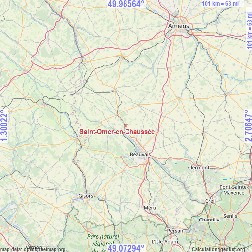
Saint-Omer-en-Chaussée GPS coordinates[2]
49° 31' 53.112" North, 2° 0' 12.06" East
| Map corner | latitude | longitude |
|---|---|---|
| Upper-left | 49.98564°, | 1.30022° |
| Center: | 49.53142°, | 2.00335° |
| Lower-right: | 49.07294°, | 2.70647° |
| Map W x H: | 101.5×101.5 km | = 63.1×63.1mi |
| max Lat: | 51.07786° ⇑10.2% North |
| Saint-Omer-en-Chaussée: | 49.53142° |
| min Lat: | ⇓89.8% South 41.3874° |
| min Long | Saint-Omer-en-C | max Long |
| -5.08615° | 2.00335° | 9.52242° |
| W 42.9%⇐ | ⇒57.1% E |
Elevation
Elevation of Saint-Omer-en-Chaussée is 104 m = 341 ft, and this is 89.7 m = 294 ft below average elevation for this country.
| Max E: |
2333 m = 7654 ft | 59.4% |
| Avg. | 193.7 m = 635 ft | |
| Saint-Omer-en-Chaussée | 104 m = 341 ft | |
Min E: |
-1 m = -3 ft | 40.6% |
See also: France elevation on elevation.city.
Geographical zone
Saint-Omer-en-Chaussée is located in North temperate zone (between Tropic of Cancer and the Arctic Circle). Distance of this North polar circle is 1893.8 km =1176.8 mi to North.| Distance of | km | miles | from Saint-Omer-en-Chaussée |
|---|---|---|---|
| North Pole | 4499.7 | 2796 | to North |
| Arctic Circle | 1893.8 | 1176.8 | to North |
| Tropic Cancer | 2901.5 | 1802.9 | to South |
| Equator | 5507.4 | 3422.1 | to South |


Nearby cities:
15 places around Saint-Omer-en-Chaussée: (largest is in red/bold)
• Crèvecœur-le-Grand
9.6 km =6 mi,  37°
37°
• Goincourt
11.9 km =7.4 mi,  168°
168°
• Hanvoile
9.1 km =5.7 mi,  254°
254°
• Herchies
4.9 km =3 mi, 174°
• Lachapelle-aux-Pots
11.7 km =7.3 mi,  218°
218°
• Le Mont-Saint-Adrien
9.5 km =5.9 mi,  179°
179°
• Luchy
8.7 km =5.4 mi,  72°
72°
• Marseille-en-Beauvaisis
6 km =3.7 mi,  324°
324°
• Milly-sur-Thérain
3.3 km =2.1 mi,  189°
189°
• Saint-Paul
11.3 km =7 mi, 178°
• Savignies
7.9 km =4.9 mi,  200°
200°
• Songeons
11 km =6.8 mi,  280°
280°
• Tillé
10.8 km =6.7 mi,  134°
134°
• Troissereux
6.5 km =4 mi,  152°
152°
• Verderel-lès-Sauqueuse
7.8 km =4.8 mi,  116°
116°
Sources, notices
• [Note1] Compared only with cities in France existing in our database
• [Src1] Map data: © OpenStreetMap contributors (CC-BY-SA)
• [Src2] Other city data from geonames.org with taken over terms of usage.
• [Src3] Geographical zone / Annual Mean Temperature by Robert A. Rohde @ Wikipedia
