Crèvecœur-le-Grand geodata
Crèvecœur-le-Grand (Hauts-de-France) is a populated place; located in France in Europe/Paris (GMT+2) time zone. With population of 3,176 people, there are 3067 cities with bigger population in this country. Compared to other cities in France, 90.6% of cities are located further ↓South; 56% of cities are located further →East and 61.3% of cities have lower elevation than Crèvecœur-le-Grand. Note1
Administrative division(s):
- Level 1: Hauts-de-France
- Level 2: Département de l'Oise
- Level 3: Arrondissement de Beauvais
- Level 4: Crèvecœur-le-Grand


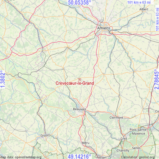
Crèvecœur-le-Grand GPS coordinates[2]
49° 36' 0" North, 2° 4' 59.988" East
| Map corner | latitude | longitude |
|---|---|---|
| Upper-left | 50.05358°, | 1.3802° |
| Center: | 49.6°, | 2.08333° |
| Lower-right: | 49.14216°, | 2.78645° |
| Map W x H: | 101.3×101.3 km | = 62.9×62.9mi |
| max Lat: | 51.07786° ⇑9.4% North |
| Crèvecœur-le-Grand: | 49.6° |
| min Lat: | ⇓90.6% South 41.3874° |
| min Long | Crèvecœur-le- | max Long |
| -5.08615° | 2.08333° | 9.52242° |
| W 44%⇐ | ⇒56% E |
Elevation
Elevation of Crèvecœur-le-Grand is 176 m = 577 ft, and this is 17.7 m = 58 ft below average elevation for this country.
| Max E: |
2333 m = 7654 ft | 38.7% |
| Avg. | 193.7 m = 635 ft | |
| Crèvecœur-le-Grand | 176 m = 577 ft | |
Min E: |
-1 m = -3 ft | 61.3% |
See also: France elevation on elevation.city.
Geographical zone
Crèvecœur-le-Grand is located in North temperate zone (between Tropic of Cancer and the Arctic Circle). Distance of this North polar circle is 1886.2 km =1172 mi to North.| Distance of | km | miles | from Crèvecœur-le-Grand |
|---|---|---|---|
| North Pole | 4492.1 | 2791.3 | to North |
| Arctic Circle | 1886.2 | 1172 | to North |
| Tropic Cancer | 2909.1 | 1807.6 | to South |
| Equator | 5515 | 3426.9 | to South |


Nearby cities:
15 places around Crèvecœur-le-Grand: (largest is in red/bold)
• Abbeville-Saint-Lucien
11.2 km =7 mi,  146°
146°
• Bonneuil-les-Eaux
14.1 km =8.8 mi,  51°
51°
• Cempuis
9.4 km =5.8 mi,  314°
314°
• Froissy
10.6 km =6.6 mi,  109°
109°
• Grandvilliers
12.6 km =7.8 mi, 305°
• Hardivillers
10.2 km =6.3 mi,  79°
79°
• Herchies
13.5 km =8.4 mi,  202°
202°
• Luchy
5.6 km =3.5 mi, 153°
• Marseille-en-Beauvaisis
9.6 km =6 mi,  253°
253°
• Milly-sur-Thérain
12.5 km =7.8 mi,  210°
210°
• Noyers-Saint-Martin
13.9 km =8.6 mi, 111°
• Oroër
12.9 km =8 mi, 153°
• Saint-Omer-en-Chaussée
9.6 km =6 mi,  217°
217°
• Troissereux
13.6 km =8.5 mi,  191°
191°
• Verderel-lès-Sauqueuse
11.2 km =7 mi,  173°
173°
Sources, notices
• [Note1] Compared only with cities in France existing in our database
• [Src1] Map data: © OpenStreetMap contributors (CC-BY-SA)
• [Src2] Other city data from geonames.org with taken over terms of usage.
• [Src3] Geographical zone / Annual Mean Temperature by Robert A. Rohde @ Wikipedia
