Saint-Mars-la-Brière geodata
Saint-Mars-la-Brière (Pays de la Loire) is a populated place; located in France in Europe/Paris (GMT+2) time zone. With population of 2,447 people, there are 3959 cities with bigger population in this country. Compared to other cities in France, 59.8% of cities are located further ↓South; 74.5% of cities are located further →East and 78.2% of cities have higher elevation than Saint-Mars-la-Brière. Note1
Administrative division(s):
- Level 1: Pays de la Loire
- Level 2: Sarthe
- Level 3: Arrondissement de Mamers
- Level 4: Saint-Mars-la-Brière


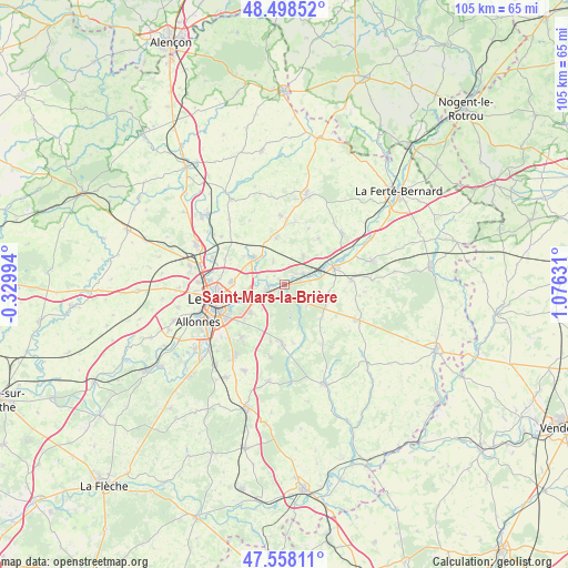
Saint-Mars-la-Brière GPS coordinates[2]
48° 1' 49.656" North, 0° 22' 23.484" East
| Map corner | latitude | longitude |
|---|---|---|
| Upper-left | 48.49852°, | -0.32994° |
| Center: | 48.03046°, | 0.37319° |
| Lower-right: | 47.55811°, | 1.07631° |
| Map W x H: | 104.6×104.6 km | = 65×65mi |
| max Lat: | 51.07786° ⇑40.2% North |
| Saint-Mars-la-Brière: | 48.03046° |
| min Lat: | ⇓59.8% South 41.3874° |
| min Long | Saint-Mars-la-B | max Long |
| -5.08615° | 0.37319° | 9.52242° |
| W 25.5%⇐ | ⇒74.5% E |
Elevation
Elevation of Saint-Mars-la-Brière is 59 m = 194 ft, and this is 134.7 m = 442 ft below average elevation for this country.
| Max E: |
2333 m = 7654 ft | 78.2% |
| Avg. | 193.7 m = 635 ft | |
| Saint-Mars-la-Brière | 59 m = 194 ft | |
Min E: |
-1 m = -3 ft | 21.8% |
See also: France elevation on elevation.city.
Geographical zone
Saint-Mars-la-Brière is located in North temperate zone (between Tropic of Cancer and the Arctic Circle). Distance of this North polar circle is 2060.7 km =1280.5 mi to North.| Distance of | km | miles | from Saint-Mars-la-Brière |
|---|---|---|---|
| North Pole | 4666.6 | 2899.7 | to North |
| Arctic Circle | 2060.7 | 1280.5 | to North |
| Tropic Cancer | 2734.6 | 1699.2 | to South |
| Equator | 5340.5 | 3318.4 | to South |


Nearby cities:
15 places around Saint-Mars-la-Brière: (largest is in red/bold)
• Challes
11.6 km =7.2 mi,  164°
164°
• Champagné
3.3 km =2.1 mi,  253°
253°
• Changé
8.4 km =5.2 mi,  232°
232°
• Connerré
9.4 km =5.8 mi,  71°
71°
• Duneau
11.7 km =7.3 mi, 68°
• Fatines
2.5 km =1.6 mi,  312°
312°
• La Chapelle-Saint-Rémy
10.6 km =6.6 mi,  36°
36°
• Le Breil-sur-Mérize
8.2 km =5.1 mi,  108°
108°
• Lombron
6.3 km =3.9 mi,  32°
32°
• Montfort-le-Gesnois
3.9 km =2.4 mi,  56°
56°
• Saint-Corneille
4.5 km =2.8 mi,  331°
331°
• Sargé-lès-le-Mans
10.4 km =6.5 mi,  271°
271°
• Sillé-le-Philippe
8.6 km =5.3 mi,  348°
348°
• Soulitré
6.5 km =4 mi, 109°
• Torcé-en-Vallée
11.4 km =7.1 mi,  8°
8°
Sources, notices
• [Note1] Compared only with cities in France existing in our database
• [Src1] Map data: © OpenStreetMap contributors (CC-BY-SA)
• [Src2] Other city data from geonames.org with taken over terms of usage.
• [Src3] Geographical zone / Annual Mean Temperature by Robert A. Rohde @ Wikipedia
