Saint-Lucien geodata
Saint-Lucien (Normandy) is a seat of a fourth-order administrative division; located in France in Europe/Paris (GMT+2) time zone. In our database, there are 15246 cities with bigger population. Compared to other cities in France, 89.4% of cities are located further ↓South; 63.7% of cities are located further →East and 62.7% of cities have lower elevation than Saint-Lucien. Note1
Administrative division(s):
- Level 1: Normandy
- Level 2: Seine-Maritime
- Level 3: Arrondissement de Dieppe
- Level 4: Saint-Lucien


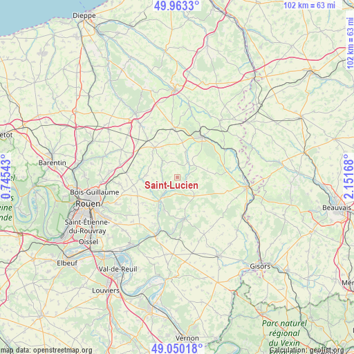
Saint-Lucien GPS coordinates[2]
49° 30' 31.932" North, 1° 26' 54.816" East
| Map corner | latitude | longitude |
|---|---|---|
| Upper-left | 49.9633°, | 0.74543° |
| Center: | 49.50887°, | 1.44856° |
| Lower-right: | 49.05018°, | 2.15168° |
| Map W x H: | 101.5×101.5 km | = 63.1×63.1mi |
| max Lat: | 51.07786° ⇑10.6% North |
| Saint-Lucien: | 49.50887° |
| min Lat: | ⇓89.4% South 41.3874° |
| min Long | Saint-Lucien | max Long |
| -5.08615° | 1.44856° | 9.52242° |
| W 36.3%⇐ | ⇒63.7% E |
Elevation
Elevation of Saint-Lucien is 183 m = 600 ft, and this is 10.7 m = 35 ft below average elevation for this country.
| Max E: |
2333 m = 7654 ft | 37.3% |
| Avg. | 193.7 m = 635 ft | |
| Saint-Lucien | 183 m = 600 ft | |
Min E: |
-1 m = -3 ft | 62.7% |
See also: France elevation on elevation.city.
Geographical zone
Saint-Lucien is located in North temperate zone (between Tropic of Cancer and the Arctic Circle). Distance of this North polar circle is 1896.3 km =1178.3 mi to North.| Distance of | km | miles | from Saint-Lucien |
|---|---|---|---|
| North Pole | 4502.2 | 2797.5 | to North |
| Arctic Circle | 1896.3 | 1178.3 | to North |
| Tropic Cancer | 2899 | 1801.4 | to South |
| Equator | 5504.9 | 3420.6 | to South |


Nearby cities:
15 places around Saint-Lucien: (largest is in red/bold)
• Auzouville-sur-Ry
12.4 km =7.7 mi,  233°
233°
• Blainville-Crevon
10.8 km =6.7 mi,  267°
267°
• Buchy
10.7 km =6.6 mi,  322°
322°
• Catenay
8.7 km =5.4 mi, 272°
• Estouteville-Écalles
13.2 km =8.2 mi,  313°
313°
• La Feuillie
6.9 km =4.3 mi,  136°
136°
• Les Hogues
10 km =6.2 mi,  201°
201°
• Lyons-la-Forêt
12.4 km =7.7 mi,  170°
170°
• Martainville-Épreville
12.5 km =7.8 mi,  244°
244°
• Perriers-sur-Andelle
11.9 km =7.4 mi,  208°
208°
• Ry
8.7 km =5.4 mi, 241°
• Saint-Denis-le-Thiboult
8.3 km =5.2 mi, 228°
• Sainte-Croix-sur-Buchy
9.4 km =5.8 mi, 311°
• Sigy-en-Bray
5.1 km =3.2 mi,  35°
35°
• Vieux-Manoir
12.8 km =8 mi,  301°
301°
Sources, notices
• [Note1] Compared only with cities in France existing in our database
• [Src1] Map data: © OpenStreetMap contributors (CC-BY-SA)
• [Src2] Other city data from geonames.org with taken over terms of usage.
• [Src3] Geographical zone / Annual Mean Temperature by Robert A. Rohde @ Wikipedia
