Saint-Léon-sur-l’Isle geodata
Saint-Léon-sur-l’Isle (Nouvelle-Aquitaine) is a populated place; located in France in Europe/Paris (GMT+2) time zone. With population of 2,013 people, there are 4768 cities with bigger population in this country. Compared to other cities in France, 78.4% of cities are located further ↑North; 73.4% of cities are located further →East and 75% of cities have higher elevation than Saint-Léon-sur-l’Isle. Note1
Administrative division(s):
- Level 1: Nouvelle-Aquitaine
- Level 2: Dordogne
- Level 3: Arrondissement de Périgueux
- Level 4: Saint-Léon-sur-l'Isle
Current local time in Saint-Léon-sur-l’Isle:
03:35 PM, SaturdayDifference from your time zone: hours


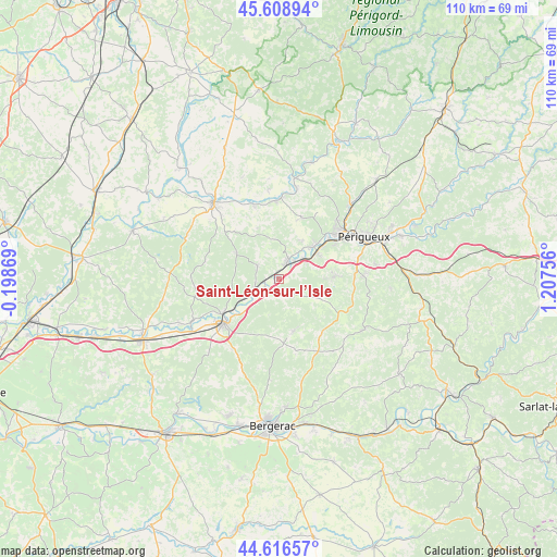
Saint-Léon-sur-l’Isle GPS coordinates[2]
45° 6' 53.676" North, 0° 30' 15.984" East
| Map corner | latitude | longitude |
|---|---|---|
| Upper-left | 45.60894°, | -0.19869° |
| Center: | 45.11491°, | 0.50444° |
| Lower-right: | 44.61657°, | 1.20756° |
| Map W x H: | 110.3×110.3 km | = 68.5×68.5mi |
| max Lat: | 51.07786° ⇑78.4% North |
| Saint-Léon-sur-l’Isle: | 45.11491° |
| min Lat: | ⇓21.6% South 41.3874° |
| min Long | Saint-Léon-sur | max Long |
| -5.08615° | 0.50444° | 9.52242° |
| W 26.6%⇐ | ⇒73.4% E |
Elevation
Elevation of Saint-Léon-sur-l’Isle is 67 m = 220 ft, and this is 126.7 m = 416 ft below average elevation for this country.
| Max E: |
2333 m = 7654 ft | 75% |
| Avg. | 193.7 m = 635 ft | |
| Saint-Léon-sur-l’Isle | 67 m = 220 ft | |
Min E: |
-1 m = -3 ft | 25% |
See also: France elevation on elevation.city.
Geographical zone
Saint-Léon-sur-l’Isle is located in North temperate zone (between Tropic of Cancer and the Arctic Circle). Distance of this North polar circle is 2384.9 km =1481.9 mi to North.| Distance of | km | miles | from Saint-Léon-sur-l’Isle |
|---|---|---|---|
| North Pole | 4990.8 | 3101.1 | to North |
| Arctic Circle | 2384.9 | 1481.9 | to North |
| Tropic Cancer | 2410.4 | 1497.8 | to South |
| Equator | 5016.3 | 3117 | to South |


Nearby cities:
15 places around Saint-Léon-sur-l’Isle: (largest is in red/bold)
• Annesse-et-Beaulieu
7.6 km =4.7 mi,  44°
44°
• Coursac
10.7 km =6.6 mi,  81°
81°
• Douzillac
7.8 km =4.8 mi,  244°
244°
• Grignols
4.5 km =2.8 mi,  142°
142°
• Manzac-sur-Vern
7.1 km =4.4 mi,  115°
115°
• Mensignac
13.1 km =8.1 mi,  20°
20°
• Montrem
7.1 km =4.4 mi,  72°
72°
• Neuvic
3.2 km =2 mi, 239°
• Razac-sur-l’Isle
9.3 km =5.8 mi,  54°
54°
• Saint-Astier
3.9 km =2.4 mi,  29°
29°
• Saint-Front-de-Pradoux
14.1 km =8.8 mi, 239°
• Saint-Germain-du-Salembre
5 km =3.1 mi,  301°
301°
• Saint-Vincent-de-Connezac
10 km =6.2 mi, 303°
• Sourzac
11.2 km =7 mi,  229°
229°
• Villamblard
10.7 km =6.6 mi,  164°
164°
Sources, notices
• [Note1] Compared only with cities in France existing in our database
• [Src1] Map data: © OpenStreetMap contributors (CC-BY-SA)
• [Src2] Other city data from geonames.org with taken over terms of usage.
• [Src3] Geographical zone / Annual Mean Temperature by Robert A. Rohde @ Wikipedia
