Neuvic geodata
Neuvic (Nouvelle-Aquitaine) is a populated place; located in France in Europe/Paris (GMT+2) time zone. With population of 3,535 people, there are 2752 cities with bigger population in this country. Compared to other cities in France, 78.5% of cities are located further ↑North; 73.7% of cities are located further →East and 73.1% of cities have higher elevation than Neuvic. Note1
Administrative division(s):
- Level 1: Nouvelle-Aquitaine
- Level 2: Dordogne
- Level 3: Arrondissement de Périgueux
- Level 4: Neuvic


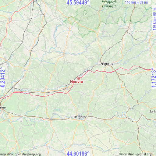
Neuvic GPS coordinates[2]
45° 6' 1.188" North, 0° 28' 8.436" East
| Map corner | latitude | longitude |
|---|---|---|
| Upper-left | 45.59449°, | -0.23412° |
| Center: | 45.10033°, | 0.46901° |
| Lower-right: | 44.60186°, | 1.17213° |
| Map W x H: | 110.4×110.4 km | = 68.6×68.6mi |
| max Lat: | 51.07786° ⇑78.5% North |
| Neuvic: | 45.10033° |
| min Lat: | ⇓21.5% South 41.3874° |
| min Long | Neuvic | max Long |
| -5.08615° | 0.46901° | 9.52242° |
| W 26.3%⇐ | ⇒73.7% E |
Elevation
Elevation of Neuvic is 71 m = 233 ft, and this is 122.7 m = 403 ft below average elevation for this country.
| Max E: |
2333 m = 7654 ft | 73.1% |
| Avg. | 193.7 m = 635 ft | |
| Neuvic | 71 m = 233 ft | |
Min E: |
-1 m = -3 ft | 26.9% |
See also: France elevation on elevation.city.
Geographical zone
Neuvic is located in North temperate zone (between Tropic of Cancer and the Arctic Circle). Distance of this North polar circle is 2386.5 km =1482.9 mi to North.| Distance of | km | miles | from Neuvic |
|---|---|---|---|
| North Pole | 4992.4 | 3102.1 | to North |
| Arctic Circle | 2386.5 | 1482.9 | to North |
| Tropic Cancer | 2408.8 | 1496.8 | to South |
| Equator | 5014.7 | 3116 | to South |


Nearby cities:
15 places around Neuvic: (largest is in red/bold)
• Annesse-et-Beaulieu
10.7 km =6.6 mi,  48°
48°
• Douzillac
4.6 km =2.9 mi,  247°
247°
• Grignols
5.9 km =3.7 mi,  109°
109°
• Manzac-sur-Vern
9.3 km =5.8 mi,  98°
98°
• Montrem
10.2 km =6.3 mi,  68°
68°
• Mussidan
11 km =6.8 mi,  229°
229°
• Razac-sur-l’Isle
12.5 km =7.8 mi,  55°
55°
• Saint-Astier
6.9 km =4.3 mi,  42°
42°
• Saint-Front-de-Pradoux
10.9 km =6.8 mi,  239°
239°
• Saint-Germain-du-Salembre
4.5 km =2.8 mi,  340°
340°
• Saint-Léon-sur-l’Isle
3.2 km =2 mi, 59°
• Saint-Médard-de-Mussidan
12 km =7.5 mi, 231°
• Saint-Vincent-de-Connezac
9 km =5.6 mi,  321°
321°
• Sourzac
8 km =5 mi, 225°
• Villamblard
10.4 km =6.5 mi,  147°
147°
Sources, notices
• [Note1] Compared only with cities in France existing in our database
• [Src1] Map data: © OpenStreetMap contributors (CC-BY-SA)
• [Src2] Other city data from geonames.org with taken over terms of usage.
• [Src3] Geographical zone / Annual Mean Temperature by Robert A. Rohde @ Wikipedia
