Sourzac geodata
Sourzac (Nouvelle-Aquitaine) is a populated place; located in France in Europe/Paris (GMT+2) time zone. With population of 1,082 people, there are 8244 cities with bigger population in this country. Compared to other cities in France, 79.1% of cities are located further ↑North; 74.4% of cities are located further →East and 66% of cities have higher elevation than Sourzac. Note1
Administrative division(s):
- Level 1: Nouvelle-Aquitaine
- Level 2: Dordogne
- Level 3: Arrondissement de Périgueux
- Level 4: Sourzac


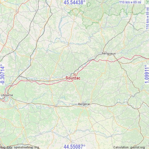
Sourzac GPS coordinates[2]
45° 2' 59.208" North, 0° 23' 45.528" East
| Map corner | latitude | longitude |
|---|---|---|
| Upper-left | 45.54438°, | -0.30714° |
| Center: | 45.04978°, | 0.39598° |
| Lower-right: | 44.55087°, | 1.09911° |
| Map W x H: | 110.5×110.5 km | = 68.7×68.7mi |
| max Lat: | 51.07786° ⇑79.1% North |
| Sourzac: | 45.04978° |
| min Lat: | ⇓20.9% South 41.3874° |
| min Long | Sourzac | max Long |
| -5.08615° | 0.39598° | 9.52242° |
| W 25.6%⇐ | ⇒74.4% E |
Elevation
Elevation of Sourzac is 87 m = 285 ft, and this is 106.7 m = 350 ft below average elevation for this country.
| Max E: |
2333 m = 7654 ft | 66% |
| Avg. | 193.7 m = 635 ft | |
| Sourzac | 87 m = 285 ft | |
Min E: |
-1 m = -3 ft | 34% |
See also: France elevation on elevation.city.
Geographical zone
Sourzac is located in North temperate zone (between Tropic of Cancer and the Arctic Circle). Distance of this North polar circle is 2392.1 km =1486.4 mi to North.| Distance of | km | miles | from Sourzac |
|---|---|---|---|
| North Pole | 4998 | 3105.6 | to North |
| Arctic Circle | 2392.1 | 1486.4 | to North |
| Tropic Cancer | 2403.1 | 1493.2 | to South |
| Equator | 5009.1 | 3112.5 | to South |


Nearby cities:
15 places around Sourzac: (largest is in red/bold)
• Douzillac
4.2 km =2.6 mi,  20°
20°
• Ginestet
15.8 km =9.8 mi,  170°
170°
• Grignols
11.9 km =7.4 mi,  71°
71°
• Manzac-sur-Vern
15.5 km =9.6 mi, 74°
• Maurens
14.5 km =9 mi,  151°
151°
• Mussidan
3.1 km =1.9 mi,  238°
238°
• Neuvic
8 km =5 mi,  45°
45°
• Saint-Astier
14.9 km =9.3 mi,  44°
44°
• Saint-Front-de-Pradoux
3.6 km =2.2 mi,  270°
270°
• Saint-Germain-du-Salembre
10.7 km =6.6 mi, 23°
• Saint-Laurent-des-Hommes
11.6 km =7.2 mi,  260°
260°
• Saint-Léon-sur-l’Isle
11.2 km =7 mi, 49°
• Saint-Médard-de-Mussidan
4 km =2.5 mi, 243°
• Saint-Vincent-de-Connezac
12.7 km =7.9 mi,  0°
0°
• Villamblard
11.7 km =7.3 mi,  105°
105°
Sources, notices
• [Note1] Compared only with cities in France existing in our database
• [Src1] Map data: © OpenStreetMap contributors (CC-BY-SA)
• [Src2] Other city data from geonames.org with taken over terms of usage.
• [Src3] Geographical zone / Annual Mean Temperature by Robert A. Rohde @ Wikipedia
