Saint-Léonard-en-Beauce geodata
Saint-Léonard-en-Beauce (Centre) is a populated place; located in France in Europe/Paris (GMT+2) time zone. With population of 557 people, there are 14072 cities with bigger population in this country. Compared to other cities in France, 56.4% of cities are located further ↓South; 64.6% of cities are located further →East and 51.9% of cities have lower elevation than Saint-Léonard-en-Beauce. Note1
Administrative division(s):
- Level 1: Centre
- Level 2: Département du Loir-et-Cher
- Level 3: Arrondissement de Blois
- Level 4: Saint-Léonard-en-Beauce
Current local time in Saint-Léonard-en-Beauce:
08:36 AM, SaturdayDifference from your time zone: hours


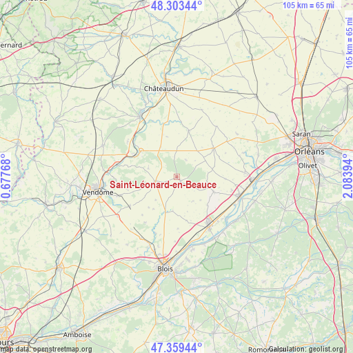
Saint-Léonard-en-Beauce GPS coordinates[2]
47° 50' 0.924" North, 1° 22' 50.916" East
| Map corner | latitude | longitude |
|---|---|---|
| Upper-left | 48.30344°, | 0.67768° |
| Center: | 47.83359°, | 1.38081° |
| Lower-right: | 47.35944°, | 2.08394° |
| Map W x H: | 105×105 km | = 65.2×65.2mi |
| max Lat: | 51.07786° ⇑43.6% North |
| Saint-Léonard-en-Beauce: | 47.83359° |
| min Lat: | ⇓56.4% South 41.3874° |
| min Long | Saint-Léonard- | max Long |
| -5.08615° | 1.38081° | 9.52242° |
| W 35.4%⇐ | ⇒64.6% E |
Elevation
Elevation of Saint-Léonard-en-Beauce is 139 m = 456 ft, and this is 54.7 m = 179 ft below average elevation for this country.
| Max E: |
2333 m = 7654 ft | 48.1% |
| Avg. | 193.7 m = 635 ft | |
| Saint-Léonard-en-Beauce | 139 m = 456 ft | |
Min E: |
-1 m = -3 ft | 51.9% |
See also: France elevation on elevation.city.
Geographical zone
Saint-Léonard-en-Beauce is located in North temperate zone (between Tropic of Cancer and the Arctic Circle). Distance of this North polar circle is 2082.6 km =1294.1 mi to North.| Distance of | km | miles | from Saint-Léonard-en-Beauce |
|---|---|---|---|
| North Pole | 4688.5 | 2913.3 | to North |
| Arctic Circle | 2082.6 | 1294.1 | to North |
| Tropic Cancer | 2712.7 | 1685.6 | to South |
| Equator | 5318.6 | 3304.8 | to South |


Nearby cities:
15 places around Saint-Léonard-en-Beauce: (largest is in red/bold)
• Binas
9.9 km =6.2 mi,  37°
37°
• Champigny-en-Beauce
16.5 km =10.3 mi,  215°
215°
• Cravant
14.2 km =8.8 mi,  92°
92°
• Fréteval
14.3 km =8.9 mi,  296°
296°
• Josnes
11.7 km =7.3 mi,  112°
112°
• La Chapelle-Saint-Martin-en-Plaine
13.2 km =8.2 mi,  168°
168°
• Marchenoir
1.6 km =1 mi,  133°
133°
• Maves
10.2 km =6.3 mi,  186°
186°
• Mer
17 km =10.6 mi,  146°
146°
• Morée
13.4 km =8.3 mi,  305°
305°
• Oucques
6.6 km =4.1 mi,  259°
259°
• Ouzouer-le-Marché
13.8 km =8.6 mi,  51°
51°
• Saint-Hilaire-la-Gravelle
16.7 km =10.4 mi, 305°
• Selommes
16.4 km =10.2 mi,  238°
238°
• Villorceau
16.6 km =10.3 mi,  102°
102°
Sources, notices
• [Note1] Compared only with cities in France existing in our database
• [Src1] Map data: © OpenStreetMap contributors (CC-BY-SA)
• [Src2] Other city data from geonames.org with taken over terms of usage.
• [Src3] Geographical zone / Annual Mean Temperature by Robert A. Rohde @ Wikipedia
