Saint-Justin geodata
Saint-Justin (Nouvelle-Aquitaine) is a populated place; located in France in Europe/Paris (GMT+2) time zone. With population of 838 people, there are 10207 cities with bigger population in this country. Compared to other cities in France, 87.2% of cities are located further ↑North; 80% of cities are located further →East and 63.2% of cities have higher elevation than Saint-Justin. Note1
Administrative division(s):
- Level 1: Nouvelle-Aquitaine
- Level 2: Landes
- Level 3: Arrondissement de Mont-de-Marsan
- Level 4: Saint-Justin


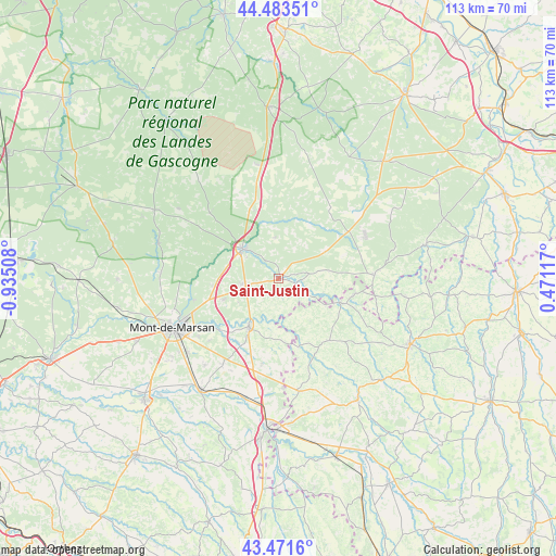
Saint-Justin GPS coordinates[2]
43° 58' 46.956" North, 0° 13' 55.056" West
| Map corner | latitude | longitude |
|---|---|---|
| Upper-left | 44.48351°, | -0.93508° |
| Center: | 43.97971°, | -0.23196° |
| Lower-right: | 43.4716°, | 0.47117° |
| Map W x H: | 112.5×112.5 km | = 69.9×69.9mi |
| max Lat: | 51.07786° ⇑87.2% North |
| Saint-Justin: | 43.97971° |
| min Lat: | ⇓12.8% South 41.3874° |
| min Long | Saint-Justin | max Long |
| -5.08615° | -0.23196° | 9.52242° |
| W 20%⇐ | ⇒80% E |
Elevation
Elevation of Saint-Justin is 94 m = 308 ft, and this is 99.7 m = 327 ft below average elevation for this country.
| Max E: |
2333 m = 7654 ft | 63.2% |
| Avg. | 193.7 m = 635 ft | |
| Saint-Justin | 94 m = 308 ft | |
Min E: |
-1 m = -3 ft | 36.8% |
See also: France elevation on elevation.city.
Geographical zone
Saint-Justin is located in North temperate zone (between Tropic of Cancer and the Arctic Circle). Distance of this Northern Tropic circle is 2284.2 km =1419.3 mi to South.| Distance of | km | miles | from Saint-Justin |
|---|---|---|---|
| North Pole | 5117 | 3179.6 | to North |
| Arctic Circle | 2511.1 | 1560.3 | to North |
| Tropic Cancer | 2284.2 | 1419.3 | to South |
| Equator | 4890.1 | 3038.6 | to South |


Nearby cities:
15 places around Saint-Justin: (largest is in red/bold)
• Bascons
22.9 km =14.2 mi,  220°
220°
• Bougue
16.3 km =10.1 mi,  232°
232°
• Cazaubon
14.1 km =8.8 mi,  111°
111°
• Estang
16.1 km =10 mi,  141°
141°
• Gabarret
19.4 km =12.1 mi,  87°
87°
• Hontanx
17.5 km =10.9 mi,  190°
190°
• Labastide-d’Armagnac
3.9 km =2.4 mi, 106°
• Laglorieuse
18.5 km =11.5 mi, 228°
• Parleboscq
19.3 km =12 mi, 105°
• Pouydesseaux
7.5 km =4.7 mi,  260°
260°
• Pujo-le-Plan
15.9 km =9.9 mi,  209°
209°
• Roquefort
9.5 km =5.9 mi,  310°
310°
• Saint-Avit
17.7 km =11 mi, 255°
• Sarbazan
7.9 km =4.9 mi,  304°
304°
• Villeneuve-de-Marsan
11.8 km =7.3 mi, 211°
Sources, notices
• [Note1] Compared only with cities in France existing in our database
• [Src1] Map data: © OpenStreetMap contributors (CC-BY-SA)
• [Src2] Other city data from geonames.org with taken over terms of usage.
• [Src3] Geographical zone / Annual Mean Temperature by Robert A. Rohde @ Wikipedia
