Cazaubon geodata
Cazaubon (Occitanie) is a populated place; located in France in Europe/Paris (GMT+2) time zone. With population of 1,628 people, there are 5734 cities with bigger population in this country. Compared to other cities in France, 87.7% of cities are located further ↑North; 78.6% of cities are located further →East and 53.1% of cities have lower elevation than Cazaubon. Note1
Administrative division(s):
- Level 1: Occitanie
- Level 2: Gers
- Level 3: Arrondissement de Condom
- Level 4: Cazaubon


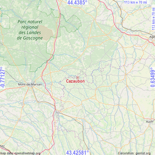
Cazaubon GPS coordinates[2]
43° 56' 3.516" North, 0° 4' 5.304" West
| Map corner | latitude | longitude |
|---|---|---|
| Upper-left | 44.4385°, | -0.77127° |
| Center: | 43.93431°, | -0.06814° |
| Lower-right: | 43.42581°, | 0.63499° |
| Map W x H: | 112.6×112.6 km | = 70×70mi |
| max Lat: | 51.07786° ⇑87.7% North |
| Cazaubon: | 43.93431° |
| min Lat: | ⇓12.3% South 41.3874° |
| min Long | Cazaubon | max Long |
| -5.08615° | -0.06814° | 9.52242° |
| W 21.4%⇐ | ⇒78.6% E |
Elevation
Elevation of Cazaubon is 143 m = 469 ft, and this is 50.7 m = 166 ft below average elevation for this country.
| Max E: |
2333 m = 7654 ft | 46.9% |
| Avg. | 193.7 m = 635 ft | |
| Cazaubon | 143 m = 469 ft | |
Min E: |
-1 m = -3 ft | 53.1% |
See also: France elevation on elevation.city.
Geographical zone
Cazaubon is located in North temperate zone (between Tropic of Cancer and the Arctic Circle). Distance of this Northern Tropic circle is 2279.1 km =1416.2 mi to South.| Distance of | km | miles | from Cazaubon |
|---|---|---|---|
| North Pole | 5122 | 3182.7 | to North |
| Arctic Circle | 2516.1 | 1563.4 | to North |
| Tropic Cancer | 2279.1 | 1416.2 | to South |
| Equator | 4885 | 3035.4 | to South |


Nearby cities:
15 places around Cazaubon: (largest is in red/bold)
• Eauze
15.9 km =9.9 mi,  121°
121°
• Estang
8.2 km =5.1 mi,  202°
202°
• Gabarret
8.6 km =5.3 mi,  46°
46°
• Hontanx
20.5 km =12.7 mi,  233°
233°
• Labastide-d’Armagnac
10.2 km =6.3 mi,  292°
292°
• Le Houga
19.8 km =12.3 mi,  206°
206°
• Manciet
17.4 km =10.8 mi,  149°
149°
• Montréal
21.8 km =13.5 mi,  85°
85°
• Nogaro
19.7 km =12.2 mi,  171°
171°
• Parleboscq
5.5 km =3.4 mi, 91°
• Pouydesseaux
20.9 km =13 mi,  280°
280°
• Saint-Justin
14.1 km =8.8 mi, 291°
• Sarbazan
21.8 km =13.5 mi,  296°
296°
• Sos
20.6 km =12.8 mi, 54°
• Villeneuve-de-Marsan
20 km =12.4 mi,  255°
255°
Sources, notices
• [Note1] Compared only with cities in France existing in our database
• [Src1] Map data: © OpenStreetMap contributors (CC-BY-SA)
• [Src2] Other city data from geonames.org with taken over terms of usage.
• [Src3] Geographical zone / Annual Mean Temperature by Robert A. Rohde @ Wikipedia
