Saint-Just-en-Chaussée geodata
Saint-Just-en-Chaussée (Hauts-de-France) is a populated place; located in France in Europe/Paris (GMT+2) time zone. With population of 5,756 people, there are 1716 cities with bigger population in this country. Compared to other cities in France, 89.3% of cities are located further ↓South; 50.5% of cities are located further →East and 61.2% of cities have higher elevation than Saint-Just-en-Chaussée. Note1
Administrative division(s):
- Level 1: Hauts-de-France
- Level 2: Département de l'Oise
- Level 3: Arrondissement de Clermont
- Level 4: Saint-Just-en-Chaussée
Current local time in Saint-Just-en-Chaussée:
04:40 AM, SaturdayDifference from your time zone: hours


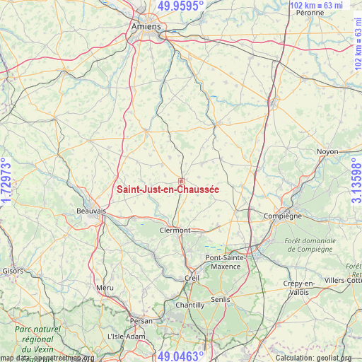
Saint-Just-en-Chaussée GPS coordinates[2]
49° 30' 18.108" North, 2° 25' 58.26" East
| Map corner | latitude | longitude |
|---|---|---|
| Upper-left | 49.9595°, | 1.72973° |
| Center: | 49.50503°, | 2.43285° |
| Lower-right: | 49.0463°, | 3.13598° |
| Map W x H: | 101.5×101.5 km | = 63.1×63.1mi |
| max Lat: | 51.07786° ⇑10.7% North |
| Saint-Just-en-Chaussée: | 49.50503° |
| min Lat: | ⇓89.3% South 41.3874° |
| min Long | Saint-Just-en-C | max Long |
| -5.08615° | 2.43285° | 9.52242° |
| W 49.5%⇐ | ⇒50.5% E |
Elevation
Elevation of Saint-Just-en-Chaussée is 99 m = 325 ft, and this is 94.7 m = 311 ft below average elevation for this country.
| Max E: |
2333 m = 7654 ft | 61.2% |
| Avg. | 193.7 m = 635 ft | |
| Saint-Just-en-Chaussée | 99 m = 325 ft | |
Min E: |
-1 m = -3 ft | 38.8% |
See also: France elevation on elevation.city.
Geographical zone
Saint-Just-en-Chaussée is located in North temperate zone (between Tropic of Cancer and the Arctic Circle). Distance of this North polar circle is 1896.7 km =1178.6 mi to North.| Distance of | km | miles | from Saint-Just-en-Chaussée |
|---|---|---|---|
| North Pole | 4502.6 | 2797.8 | to North |
| Arctic Circle | 1896.7 | 1178.6 | to North |
| Tropic Cancer | 2898.5 | 1801 | to South |
| Equator | 5504.4 | 3420.3 | to South |


Nearby cities:
15 places around Saint-Just-en-Chaussée: (largest is in red/bold)
• Airion
8.9 km =5.5 mi,  187°
187°
• Ansauvillers
7.5 km =4.7 mi,  333°
333°
• Avrechy
6.4 km =4 mi,  183°
183°
• Bulles
9.3 km =5.8 mi,  236°
236°
• Catillon-Fumechon
5 km =3.1 mi,  285°
285°
• Erquery
10.9 km =6.8 mi,  170°
170°
• Fitz-James
12.7 km =7.9 mi, 180°
• Fournival
5.6 km =3.5 mi,  219°
219°
• La Neuville-Roy
11.1 km =6.9 mi,  102°
102°
• Lieuvillers
6.1 km =3.8 mi,  129°
129°
• Maignelay-Montigny
7.8 km =4.8 mi,  50°
50°
• Ravenel
5.1 km =3.2 mi,  77°
77°
• Tricot
12.8 km =8 mi,  61°
61°
• Wavignies
7 km =4.3 mi,  312°
312°
• Étouy
10.8 km =6.7 mi,  207°
207°
Sources, notices
• [Note1] Compared only with cities in France existing in our database
• [Src1] Map data: © OpenStreetMap contributors (CC-BY-SA)
• [Src2] Other city data from geonames.org with taken over terms of usage.
• [Src3] Geographical zone / Annual Mean Temperature by Robert A. Rohde @ Wikipedia
