Lieuvillers geodata
Lieuvillers (Hauts-de-France) is a populated place; located in France in Europe/Paris (GMT+2) time zone. With population of 545 people, there are 14306 cities with bigger population in this country. Compared to other cities in France, 88.8% of cities are located further ↓South; 50.6% of cities are located further ←West and 53.1% of cities have higher elevation than Lieuvillers. Note1
Administrative division(s):
- Level 1: Hauts-de-France
- Level 2: Département de l'Oise
- Level 3: Arrondissement de Clermont
- Level 4: Lieuvillers


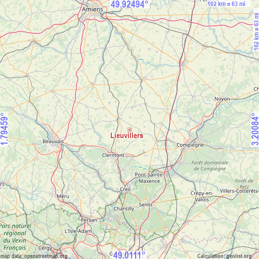
Lieuvillers GPS coordinates[2]
49° 28' 12.54" North, 2° 29' 51.792" East
| Map corner | latitude | longitude |
|---|---|---|
| Upper-left | 49.92494°, | 1.79459° |
| Center: | 49.47015°, | 2.49772° |
| Lower-right: | 49.0111°, | 3.20084° |
| Map W x H: | 101.6×101.6 km | = 63.1×63.1mi |
| max Lat: | 51.07786° ⇑11.2% North |
| Lieuvillers: | 49.47015° |
| min Lat: | ⇓88.8% South 41.3874° |
| min Long | Lieuvillers | max Long |
| -5.08615° | 2.49772° | 9.52242° |
| W 50.6%⇐ | ⇒49.4% E |
Elevation
Elevation of Lieuvillers is 122 m = 400 ft, and this is 71.7 m = 235 ft below average elevation for this country.
| Max E: |
2333 m = 7654 ft | 53.1% |
| Avg. | 193.7 m = 635 ft | |
| Lieuvillers | 122 m = 400 ft | |
Min E: |
-1 m = -3 ft | 46.9% |
See also: France elevation on elevation.city.
Geographical zone
Lieuvillers is located in North temperate zone (between Tropic of Cancer and the Arctic Circle). Distance of this North polar circle is 1900.6 km =1181 mi to North.| Distance of | km | miles | from Lieuvillers |
|---|---|---|---|
| North Pole | 4506.5 | 2800.2 | to North |
| Arctic Circle | 1900.6 | 1181 | to North |
| Tropic Cancer | 2894.6 | 1798.6 | to South |
| Equator | 5500.6 | 3417.9 | to South |


Nearby cities:
15 places around Lieuvillers: (largest is in red/bold)
• Airion
7.7 km =4.8 mi,  229°
229°
• Avrechy
5.7 km =3.5 mi,  244°
244°
• Bailleul-le-Soc
8.3 km =5.2 mi,  135°
135°
• Breuil-le-Sec
11.5 km =7.1 mi,  197°
197°
• Catenoy
11.4 km =7.1 mi,  175°
175°
• Catillon-Fumechon
10.8 km =6.7 mi,  298°
298°
• Erquery
7.4 km =4.6 mi, 203°
• Fitz-James
10 km =6.2 mi,  208°
208°
• Fournival
8.3 km =5.2 mi,  267°
267°
• La Neuville-Roy
6.4 km =4 mi,  76°
76°
• Maignelay-Montigny
9 km =5.6 mi,  8°
8°
• Moyenneville
10.2 km =6.3 mi, 77°
• Ravenel
5 km =3.1 mi,  3°
3°
• Saint-Just-en-Chaussée
6.1 km =3.8 mi,  309°
309°
• Étouy
11.3 km =7 mi, 239°
Sources, notices
• [Note1] Compared only with cities in France existing in our database
• [Src1] Map data: © OpenStreetMap contributors (CC-BY-SA)
• [Src2] Other city data from geonames.org with taken over terms of usage.
• [Src3] Geographical zone / Annual Mean Temperature by Robert A. Rohde @ Wikipedia
