Ceyzériat geodata
Ceyzériat (Auvergne-Rhône-Alpes) is a populated place; located in France in Europe/Paris (GMT+2) time zone. With population of 2,639 people, there are 3695 cities with bigger population in this country. Compared to other cities in France, 63.9% of cities are located further ↑North; 80.8% of cities are located further ←West and 83.3% of cities have lower elevation than Ceyzériat. Note1
Administrative division(s):
- Level 1: Auvergne-Rhône-Alpes
- Level 2: Département de l'Ain
- Level 3: Arrondissement de Bourg-en-Bresse
- Level 4: Ceyzériat


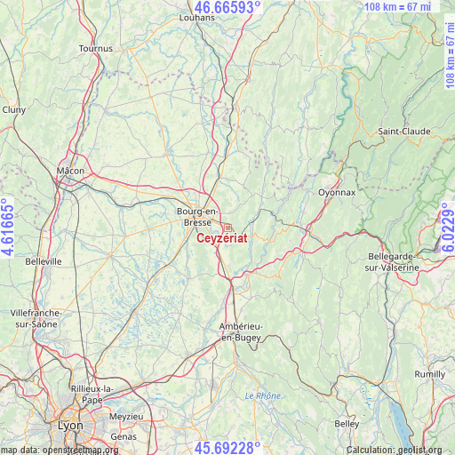
Ceyzériat GPS coordinates[2]
46° 10' 52.536" North, 5° 19' 11.172" East
| Map corner | latitude | longitude |
|---|---|---|
| Upper-left | 46.66593°, | 4.61665° |
| Center: | 46.18126°, | 5.31977° |
| Lower-right: | 45.69228°, | 6.0229° |
| Map W x H: | 108.3×108.3 km | = 67.3×67.3mi |
| max Lat: | 51.07786° ⇑63.9% North |
| Ceyzériat: | 46.18126° |
| min Lat: | ⇓36.1% South 41.3874° |
| min Long | Ceyzériat | max Long |
| -5.08615° | 5.31977° | 9.52242° |
| W 80.8%⇐ | ⇒19.2% E |
Elevation
Elevation of Ceyzériat is 325 m = 1066 ft, and this is 131.3 m = 431 ft above average elevation for this country.
| Max E: |
2333 m = 7654 ft | 16.7% |
| Ceyzériat | 325 m 1066 ft | |
| Avg. | 193.7 m = 635 ft | |
Min E: |
-1 m = -3 ft | 83.3% |
See also: France elevation on elevation.city.
Geographical zone
Ceyzériat is located in North temperate zone (between Tropic of Cancer and the Arctic Circle). Distance of this North polar circle is 2266.3 km =1408.2 mi to North.| Distance of | km | miles | from Ceyzériat |
|---|---|---|---|
| North Pole | 4872.2 | 3027.4 | to North |
| Arctic Circle | 2266.3 | 1408.2 | to North |
| Tropic Cancer | 2529 | 1571.4 | to South |
| Equator | 5134.9 | 3190.7 | to South |


Nearby cities:
15 places around Ceyzériat: (largest is in red/bold)
• Bohas-Meyriat-Rignat
5.8 km =3.6 mi,  114°
114°
• Bourg-en-Bresse
7.7 km =4.8 mi,  290°
290°
• Certines
6.9 km =4.3 mi,  217°
217°
• Hautecourt-Romanèche
7.8 km =4.8 mi, 107°
• Jasseron
3.6 km =2.2 mi,  7°
7°
• Meillonnas
7.3 km =4.5 mi,  18°
18°
• Montagnat
2.9 km =1.8 mi,  238°
238°
• Péronnas
8.4 km =5.2 mi,  271°
271°
• Revonnas
2 km =1.2 mi,  157°
157°
• Saint-Just
3.3 km =2.1 mi, 289°
• Saint-Martin-du-Mont
9.3 km =5.8 mi,  181°
181°
• Simandre-sur-Suran
9.1 km =5.7 mi,  55°
55°
• Tossiat
4.7 km =2.9 mi,  187°
187°
• Treffort-Cuisiat
10.2 km =6.3 mi, 20°
• Villereversure
4.9 km =3 mi,  84°
84°
Sources, notices
• [Note1] Compared only with cities in France existing in our database
• [Src1] Map data: © OpenStreetMap contributors (CC-BY-SA)
• [Src2] Other city data from geonames.org with taken over terms of usage.
• [Src3] Geographical zone / Annual Mean Temperature by Robert A. Rohde @ Wikipedia
