Saint-Jouin-de-Marnes geodata
Saint-Jouin-de-Marnes (Nouvelle-Aquitaine) is a populated place; located in France in Europe/Paris (GMT+2) time zone. With population of 586 people, there are 13542 cities with bigger population in this country. Compared to other cities in France, 56.4% of cities are located further ↑North; 78.5% of cities are located further →East and 61.2% of cities have higher elevation than Saint-Jouin-de-Marnes. Note1
Administrative division(s):
- Level 1: Nouvelle-Aquitaine
- Level 2: Département des Deux-Sèvres
- Level 3: Arrondissement de Bressuire
- Level 4: Plaine-et-Vallées
Current local time in Saint-Jouin-de-Marnes:
11:50 AM, SaturdayDifference from your time zone: hours


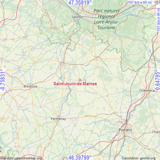
Saint-Jouin-de-Marnes GPS coordinates[2]
46° 52' 50.664" North, 0° 3' 18.648" West
| Map corner | latitude | longitude |
|---|---|---|
| Upper-left | 47.35919°, | -0.75831° |
| Center: | 46.88074°, | -0.05518° |
| Lower-right: | 46.39799°, | 0.64795° |
| Map W x H: | 106.9×106.9 km | = 66.4×66.4mi |
| max Lat: | 51.07786° ⇑56.4% North |
| Saint-Jouin-de-Marnes: | 46.88074° |
| min Lat: | ⇓43.6% South 41.3874° |
| min Long | Saint-Jouin-de- | max Long |
| -5.08615° | -0.05518° | 9.52242° |
| W 21.5%⇐ | ⇒78.5% E |
Elevation
Elevation of Saint-Jouin-de-Marnes is 99 m = 325 ft, and this is 94.7 m = 311 ft below average elevation for this country.
| Max E: |
2333 m = 7654 ft | 61.2% |
| Avg. | 193.7 m = 635 ft | |
| Saint-Jouin-de-Marnes | 99 m = 325 ft | |
Min E: |
-1 m = -3 ft | 38.8% |
See also: France elevation on elevation.city.
Geographical zone
Saint-Jouin-de-Marnes is located in North temperate zone (between Tropic of Cancer and the Arctic Circle). Distance of this North polar circle is 2188.5 km =1359.9 mi to North.| Distance of | km | miles | from Saint-Jouin-de-Marnes |
|---|---|---|---|
| North Pole | 4794.4 | 2979.1 | to North |
| Arctic Circle | 2188.5 | 1359.9 | to North |
| Tropic Cancer | 2606.7 | 1619.7 | to South |
| Equator | 5212.6 | 3239 | to South |


Nearby cities:
15 places around Saint-Jouin-de-Marnes: (largest is in red/bold)
• Airvault
8.7 km =5.4 mi,  226°
226°
• Angliers
14.9 km =9.3 mi,  60°
60°
• Assais-les-Jumeaux
10.8 km =6.7 mi,  177°
177°
• Chalais
14.8 km =9.2 mi,  46°
46°
• Glénay
15.1 km =9.4 mi,  261°
261°
• Louin
11.8 km =7.3 mi,  222°
222°
• Luzay
11.7 km =7.3 mi,  294°
294°
• Missé
12.8 km =8 mi,  305°
305°
• Moncontour
2.9 km =1.8 mi,  87°
87°
• Mouterre-Silly
13 km =8.1 mi,  35°
35°
• Oiron
8.1 km =5 mi,  345°
345°
• Saint-Jean-de-Sauves
12.1 km =7.5 mi,  111°
111°
• Saint-Léger-de-Montbrun
14.5 km =9 mi,  335°
335°
• Saint-Varent
13.5 km =8.4 mi,  274°
274°
• Taizé
6.7 km =4.2 mi,  317°
317°
Sources, notices
• [Note1] Compared only with cities in France existing in our database
• [Src1] Map data: © OpenStreetMap contributors (CC-BY-SA)
• [Src2] Other city data from geonames.org with taken over terms of usage.
• [Src3] Geographical zone / Annual Mean Temperature by Robert A. Rohde @ Wikipedia
