Orist geodata
Orist (Nouvelle-Aquitaine) is a populated place; located in France in Europe/Paris (GMT+2) time zone. With population of 582 people, there are 13612 cities with bigger population in this country. Compared to other cities in France, 91.3% of cities are located further ↑North; 89.8% of cities are located further →East and 88.3% of cities have higher elevation than Orist. Note1
Administrative division(s):
- Level 1: Nouvelle-Aquitaine
- Level 2: Landes
- Level 3: Arrondissement de Dax
- Level 4: Orist


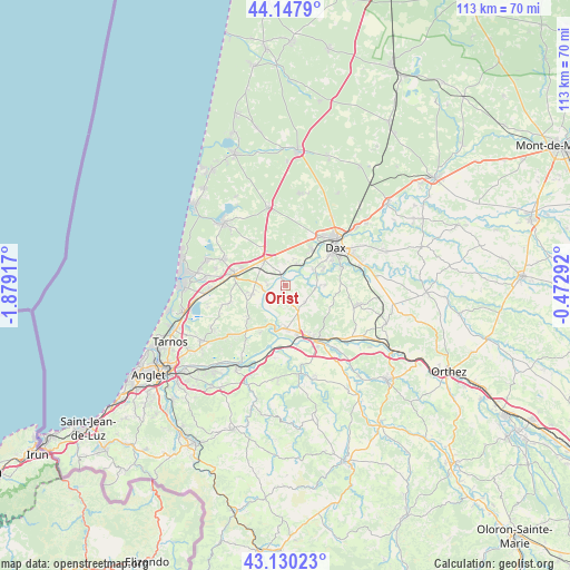
Orist GPS coordinates[2]
43° 38' 28.392" North, 1° 10' 33.744" West
| Map corner | latitude | longitude |
|---|---|---|
| Upper-left | 44.1479°, | -1.87917° |
| Center: | 43.64122°, | -1.17604° |
| Lower-right: | 43.13023°, | -0.47292° |
| Map W x H: | 113.2×113.2 km | = 70.3×70.3mi |
| max Lat: | 51.07786° ⇑91.3% North |
| Orist: | 43.64122° |
| min Lat: | ⇓8.7% South 41.3874° |
| min Long | Orist | max Long |
| -5.08615° | -1.17604° | 9.52242° |
| W 10.2%⇐ | ⇒89.8% E |
Elevation
Elevation of Orist is 34 m = 112 ft, and this is 159.7 m = 524 ft below average elevation for this country.
| Max E: |
2333 m = 7654 ft | 88.3% |
| Avg. | 193.7 m = 635 ft | |
| Orist | 34 m = 112 ft | |
Min E: |
-1 m = -3 ft | 11.7% |
See also: France elevation on elevation.city.
Geographical zone
Orist is located in North temperate zone (between Tropic of Cancer and the Arctic Circle). Distance of this Northern Tropic circle is 2246.5 km =1395.9 mi to South.| Distance of | km | miles | from Orist |
|---|---|---|---|
| North Pole | 5154.6 | 3202.9 | to North |
| Arctic Circle | 2548.7 | 1583.7 | to North |
| Tropic Cancer | 2246.5 | 1395.9 | to South |
| Equator | 4852.4 | 3015.1 | to South |


Nearby cities:
15 places around Orist: (largest is in red/bold)
• Cagnotte
10.1 km =6.3 mi,  120°
120°
• Heugas
7.6 km =4.7 mi,  88°
88°
• Josse
3.5 km =2.2 mi,  271°
271°
• Mées
8.8 km =5.5 mi,  37°
37°
• Oeyreluy
8.1 km =5 mi,  67°
67°
• Orthevielle
10.1 km =6.3 mi,  167°
167°
• Pey
2.4 km =1.5 mi,  235°
235°
• Port-de-Lanne
8.5 km =5.3 mi,  181°
181°
• Rivière-Saas-et-Gourby
4.8 km =3 mi,  26°
26°
• Saint-Geours-de-Maremne
6.9 km =4.3 mi,  321°
321°
• Saint-Jean-de-Marsacq
6.7 km =4.2 mi,  255°
255°
• Saint-Lon-les-Mines
5.1 km =3.2 mi,  128°
128°
• Saint-Martin-de-Hinx
9.9 km =6.2 mi,  228°
228°
• Saubusse
2.1 km =1.3 mi,  338°
338°
• Tercis-les-Bains
6.4 km =4 mi,  59°
59°
Sources, notices
• [Note1] Compared only with cities in France existing in our database
• [Src1] Map data: © OpenStreetMap contributors (CC-BY-SA)
• [Src2] Other city data from geonames.org with taken over terms of usage.
• [Src3] Geographical zone / Annual Mean Temperature by Robert A. Rohde @ Wikipedia
