Ladignac-le-Long geodata
Ladignac-le-Long (Nouvelle-Aquitaine) is a populated place; located in France in Europe/Paris (GMT+2) time zone. With population of 1,116 people, there are 8036 cities with bigger population in this country. Compared to other cities in France, 72.9% of cities are located further ↑North; 67.7% of cities are located further →East and 88.3% of cities have lower elevation than Ladignac-le-Long. Note1
Administrative division(s):
- Level 1: Nouvelle-Aquitaine
- Level 2: Haute-Vienne
- Level 3: Arrondissement de Limoges
- Level 4: Ladignac-le-Long


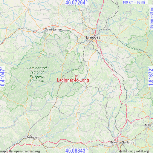
Ladignac-le-Long GPS coordinates[2]
45° 34' 57.684" North, 1° 6' 48.96" East
| Map corner | latitude | longitude |
|---|---|---|
| Upper-left | 46.07264°, | 0.41047° |
| Center: | 45.58269°, | 1.1136° |
| Lower-right: | 45.08843°, | 1.81672° |
| Map W x H: | 109.4×109.4 km | = 68×68mi |
| max Lat: | 51.07786° ⇑72.9% North |
| Ladignac-le-Long: | 45.58269° |
| min Lat: | ⇓27.1% South 41.3874° |
| min Long | Ladignac-le-Lon | max Long |
| -5.08615° | 1.1136° | 9.52242° |
| W 32.3%⇐ | ⇒67.7% E |
Elevation
Elevation of Ladignac-le-Long is 394 m = 1293 ft, and this is 200.3 m = 657 ft above average elevation for this country.
| Max E: |
2333 m = 7654 ft | 11.7% |
| Ladignac-le-Long | 394 m 1293 ft | |
| Avg. | 193.7 m = 635 ft | |
Min E: |
-1 m = -3 ft | 88.3% |
See also: France elevation on elevation.city.
Geographical zone
Ladignac-le-Long is located in North temperate zone (between Tropic of Cancer and the Arctic Circle). Distance of this North polar circle is 2332.9 km =1449.6 mi to North.| Distance of | km | miles | from Ladignac-le-Long |
|---|---|---|---|
| North Pole | 4938.7 | 3068.8 | to North |
| Arctic Circle | 2332.9 | 1449.6 | to North |
| Tropic Cancer | 2462.4 | 1530.1 | to South |
| Equator | 5068.3 | 3149.3 | to South |


Nearby cities:
15 places around Ladignac-le-Long: (largest is in red/bold)
• Bussière-Galant
7.8 km =4.8 mi,  309°
309°
• Châlus
13.1 km =8.1 mi, 307°
• Flavignac
13.6 km =8.5 mi,  352°
352°
• Glandon
14.4 km =8.9 mi,  142°
142°
• Jumilhac-le-Grand
10.6 km =6.6 mi,  201°
201°
• La Coquille
11.6 km =7.2 mi,  246°
246°
• La Meyze
8.7 km =5.4 mi,  64°
64°
• Les Cars
11.4 km =7.1 mi,  343°
343°
• Nexon
12.1 km =7.5 mi,  27°
27°
• Pageas
13.8 km =8.6 mi,  320°
320°
• Saint-Hilaire-les-Places
7.8 km =4.8 mi, 27°
• Saint-Maurice-les-Brousses
16.1 km =10 mi,  36°
36°
• Saint-Paul-la-Roche
14.7 km =9.1 mi,  217°
217°
• Saint-Priest-Ligoure
15.8 km =9.8 mi, 61°
• Saint-Yrieix-la-Perche
10.3 km =6.4 mi, 137°
Sources, notices
• [Note1] Compared only with cities in France existing in our database
• [Src1] Map data: © OpenStreetMap contributors (CC-BY-SA)
• [Src2] Other city data from geonames.org with taken over terms of usage.
• [Src3] Geographical zone / Annual Mean Temperature by Robert A. Rohde @ Wikipedia
