Saint-Georges-le-Gaultier geodata
Saint-Georges-le-Gaultier (Pays de la Loire) is a populated place; located in France in Europe/Paris (GMT+2) time zone. With population of 569 people, there are 13839 cities with bigger population in this country. Compared to other cities in France, 64.5% of cities are located further ↓South; 78.9% of cities are located further →East and 51.1% of cities have lower elevation than Saint-Georges-le-Gaultier. Note1
Administrative division(s):
- Level 1: Pays de la Loire
- Level 2: Sarthe
- Level 3: Arrondissement de Mamers
- Level 4: Saint-Georges-le-Gaultier
Current local time in Saint-Georges-le-Gaultier:
05:38 PM, SaturdayDifference from your time zone: hours


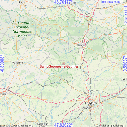
Saint-Georges-le-Gaultier GPS coordinates[2]
48° 17' 46.104" North, 0° 6' 24.3" West
| Map corner | latitude | longitude |
|---|---|---|
| Upper-left | 48.76177°, | -0.80988° |
| Center: | 48.29614°, | -0.10675° |
| Lower-right: | 47.82622°, | 0.59637° |
| Map W x H: | 104×104 km | = 64.6×64.6mi |
| max Lat: | 51.07786° ⇑35.5% North |
| Saint-Georges-le-Gaultier: | 48.29614° |
| min Lat: | ⇓64.5% South 41.3874° |
| min Long | Saint-Georges-l | max Long |
| -5.08615° | -0.10675° | 9.52242° |
| W 21.1%⇐ | ⇒78.9% E |
Elevation
Elevation of Saint-Georges-le-Gaultier is 136 m = 446 ft, and this is 57.7 m = 189 ft below average elevation for this country.
| Max E: |
2333 m = 7654 ft | 48.9% |
| Avg. | 193.7 m = 635 ft | |
| Saint-Georges-le-Gaultier | 136 m = 446 ft | |
Min E: |
-1 m = -3 ft | 51.1% |
See also: France elevation on elevation.city.
Geographical zone
Saint-Georges-le-Gaultier is located in North temperate zone (between Tropic of Cancer and the Arctic Circle). Distance of this North polar circle is 2031.1 km =1262.1 mi to North.| Distance of | km | miles | from Saint-Georges-le-Gaultier |
|---|---|---|---|
| North Pole | 4637 | 2881.3 | to North |
| Arctic Circle | 2031.1 | 1262.1 | to North |
| Tropic Cancer | 2764.1 | 1717.5 | to South |
| Equator | 5370 | 3336.8 | to South |


Nearby cities:
15 places around Saint-Georges-le-Gaultier: (largest is in red/bold)
• Assé-le-Boisne
7.8 km =4.8 mi,  68°
68°
• Averton
9.4 km =5.8 mi,  294°
294°
• Courcité
10.6 km =6.6 mi,  276°
276°
• Fresnay-sur-Sarthe
9.7 km =6 mi,  99°
99°
• Gesnes-le-Gandelin
11.3 km =7 mi,  55°
55°
• Gesvres
8.6 km =5.3 mi,  339°
339°
• Mont-Saint-Jean
5.8 km =3.6 mi,  182°
182°
• Moulins-le-Carbonnel
10.5 km =6.5 mi,  34°
34°
• Saint-Aubin-de-Locquenay
10.1 km =6.3 mi,  106°
106°
• Saint-Léonard-des-Bois
6.6 km =4.1 mi,  19°
19°
• Saint-Ouen-de-Mimbré
11.5 km =7.1 mi,  92°
92°
• Saint-Pierre-des-Nids
11.4 km =7.1 mi,  2°
2°
• Saint-Pierre-sur-Orthe
12.1 km =7.5 mi,  217°
217°
• Saint-Rémy-de-Sillé
12.2 km =7.6 mi, 175°
• Sougé-le-Ganelon
6.2 km =3.9 mi, 67°
Sources, notices
• [Note1] Compared only with cities in France existing in our database
• [Src1] Map data: © OpenStreetMap contributors (CC-BY-SA)
• [Src2] Other city data from geonames.org with taken over terms of usage.
• [Src3] Geographical zone / Annual Mean Temperature by Robert A. Rohde @ Wikipedia
