Assé-le-Boisne geodata
Assé-le-Boisne (Pays de la Loire) is a populated place; located in France in Europe/Paris (GMT+2) time zone. With population of 864 people, there are 9950 cities with bigger population in this country. Compared to other cities in France, 65% of cities are located further ↓South; 78.2% of cities are located further →East and 53.3% of cities have lower elevation than Assé-le-Boisne. Note1
Administrative division(s):
- Level 1: Pays de la Loire
- Level 2: Sarthe
- Level 3: Arrondissement de Mamers
- Level 4: Assé-le-Boisne


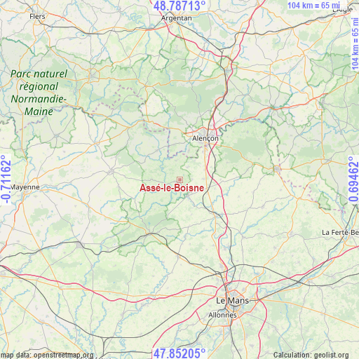
Assé-le-Boisne GPS coordinates[2]
48° 19' 18.228" North, 0° 0' 30.6" West
| Map corner | latitude | longitude |
|---|---|---|
| Upper-left | 48.78713°, | -0.71162° |
| Center: | 48.32173°, | -0.0085° |
| Lower-right: | 47.85205°, | 0.69462° |
| Map W x H: | 104×104 km | = 64.6×64.6mi |
| max Lat: | 51.07786° ⇑35% North |
| Assé-le-Boisne: | 48.32173° |
| min Lat: | ⇓65% South 41.3874° |
| min Long | Assé-le-Boisne | max Long |
| -5.08615° | -0.0085° | 9.52242° |
| W 21.8%⇐ | ⇒78.2% E |
Elevation
Elevation of Assé-le-Boisne is 144 m = 472 ft, and this is 49.7 m = 163 ft below average elevation for this country.
| Max E: |
2333 m = 7654 ft | 46.7% |
| Avg. | 193.7 m = 635 ft | |
| Assé-le-Boisne | 144 m = 472 ft | |
Min E: |
-1 m = -3 ft | 53.3% |
See also: France elevation on elevation.city.
Geographical zone
Assé-le-Boisne is located in North temperate zone (between Tropic of Cancer and the Arctic Circle). Distance of this North polar circle is 2028.3 km =1260.3 mi to North.| Distance of | km | miles | from Assé-le-Boisne |
|---|---|---|---|
| North Pole | 4634.2 | 2879.6 | to North |
| Arctic Circle | 2028.3 | 1260.3 | to North |
| Tropic Cancer | 2767 | 1719.3 | to South |
| Equator | 5372.9 | 3338.6 | to South |


Nearby cities:
15 places around Assé-le-Boisne: (largest is in red/bold)
• Arçonnay
10.9 km =6.8 mi,  39°
39°
• Fresnay-sur-Sarthe
5 km =3.1 mi,  152°
152°
• Fyé
6.6 km =4.1 mi,  86°
86°
• Gesnes-le-Gandelin
4.2 km =2.6 mi,  29°
29°
• Héloup
8.8 km =5.5 mi,  17°
17°
• La Ferrière-Bochard
10.3 km =6.4 mi,  349°
349°
• Mieuxcé
8.9 km =5.5 mi,  9°
9°
• Moulins-le-Carbonnel
5.9 km =3.7 mi, 348°
• Oisseau-le-Petit
7.6 km =4.7 mi,  67°
67°
• Saint-Aubin-de-Locquenay
6.3 km =3.9 mi,  157°
157°
• Saint-Georges-le-Gaultier
7.8 km =4.8 mi,  248°
248°
• Saint-Léonard-des-Bois
6.1 km =3.8 mi,  303°
303°
• Saint-Ouen-de-Mimbré
5.3 km =3.3 mi,  127°
127°
• Saint-Pierre-des-Nids
10.9 km =6.8 mi,  321°
321°
• Sougé-le-Ganelon
1.6 km =1 mi, 254°
Sources, notices
• [Note1] Compared only with cities in France existing in our database
• [Src1] Map data: © OpenStreetMap contributors (CC-BY-SA)
• [Src2] Other city data from geonames.org with taken over terms of usage.
• [Src3] Geographical zone / Annual Mean Temperature by Robert A. Rohde @ Wikipedia
