Saint-Georges-de-Didonne geodata
Saint-Georges-de-Didonne (Nouvelle-Aquitaine) is a populated place; located in France in Europe/Paris (GMT+2) time zone. With population of 5,406 people, there are 1822 cities with bigger population in this country. Compared to other cities in France, 72.5% of cities are located further ↑North; 88.2% of cities are located further →East and 96% of cities have higher elevation than Saint-Georges-de-Didonne. Note1
Administrative division(s):
- Level 1: Nouvelle-Aquitaine
- Level 2: Charente-Maritime
- Level 3: Arrondissement de Rochefort
- Level 4: Saint-Georges-de-Didonne
Current local time in Saint-Georges-de-Didonne:
02:30 PM, SaturdayDifference from your time zone: hours


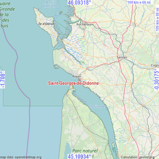
Saint-Georges-de-Didonne GPS coordinates[2]
45° 36' 12.312" North, 1° 0' 17.532" West
| Map corner | latitude | longitude |
|---|---|---|
| Upper-left | 46.09318°, | -1.708° |
| Center: | 45.60342°, | -1.00487° |
| Lower-right: | 45.10934°, | -0.30175° |
| Map W x H: | 109.4×109.4 km | = 68×68mi |
| max Lat: | 51.07786° ⇑72.5% North |
| Saint-Georges-de-Didonne: | 45.60342° |
| min Lat: | ⇓27.5% South 41.3874° |
| min Long | Saint-Georges-d | max Long |
| -5.08615° | -1.00487° | 9.52242° |
| W 11.8%⇐ | ⇒88.2% E |
Elevation
Elevation of Saint-Georges-de-Didonne is 14 m = 46 ft, and this is 179.7 m = 590 ft below average elevation for this country.
| Max E: |
2333 m = 7654 ft | 96% |
| Avg. | 193.7 m = 635 ft | |
| Saint-Georges-de-Didonne | 14 m = 46 ft | |
Min E: |
-1 m = -3 ft | 4% |
See also: France elevation on elevation.city.
Geographical zone
Saint-Georges-de-Didonne is located in North temperate zone (between Tropic of Cancer and the Arctic Circle). Distance of this North polar circle is 2330.5 km =1448.1 mi to North.| Distance of | km | miles | from Saint-Georges-de-Didonne |
|---|---|---|---|
| North Pole | 4936.4 | 3067.3 | to North |
| Arctic Circle | 2330.5 | 1448.1 | to North |
| Tropic Cancer | 2464.7 | 1531.5 | to South |
| Equator | 5070.6 | 3150.7 | to South |


Nearby cities:
15 places around Saint-Georges-de-Didonne: (largest is in red/bold)
• Arces
12.3 km =7.6 mi,  118°
118°
• Breuillet
10.4 km =6.5 mi,  339°
339°
• Corme-Écluse
11.9 km =7.4 mi,  75°
75°
• Le Chay
9.4 km =5.8 mi,  65°
65°
• Le Verdon-sur-Mer
7.9 km =4.9 mi,  214°
214°
• Meschers-sur-Gironde
6.2 km =3.9 mi,  140°
140°
• Mornac-sur-Seudre
11.9 km =7.4 mi,  351°
351°
• Médis
5.5 km =3.4 mi,  36°
36°
• Royan
3.3 km =2.1 mi,  327°
327°
• Saint-Augustin
12.1 km =7.5 mi,  317°
317°
• Saint-Palais-sur-Mer
7.8 km =4.8 mi,  303°
303°
• Saint-Sulpice-de-Royan
7.5 km =4.7 mi,  355°
355°
• Saujon
9.9 km =6.2 mi, 38°
• Semussac
6.9 km =4.3 mi,  93°
93°
• Vaux-sur-Mer
6.3 km =3.9 mi, 318°
Sources, notices
• [Note1] Compared only with cities in France existing in our database
• [Src1] Map data: © OpenStreetMap contributors (CC-BY-SA)
• [Src2] Other city data from geonames.org with taken over terms of usage.
• [Src3] Geographical zone / Annual Mean Temperature by Robert A. Rohde @ Wikipedia
