Médis geodata
Médis (Nouvelle-Aquitaine) is a populated place; located in France in Europe/Paris (GMT+2) time zone. With population of 2,550 people, there are 3826 cities with bigger population in this country. Compared to other cities in France, 71.9% of cities are located further ↑North; 87.9% of cities are located further →East and 94.4% of cities have higher elevation than Médis. Note1
Administrative division(s):
- Level 1: Nouvelle-Aquitaine
- Level 2: Charente-Maritime
- Level 3: Arrondissement de Saintes
- Level 4: Médis


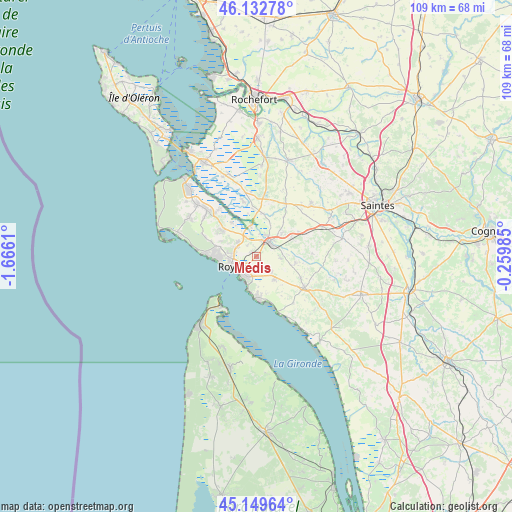
Médis GPS coordinates[2]
45° 38' 36.132" North, 0° 57' 46.728" West
| Map corner | latitude | longitude |
|---|---|---|
| Upper-left | 46.13278°, | -1.6661° |
| Center: | 45.64337°, | -0.96298° |
| Lower-right: | 45.14964°, | -0.25985° |
| Map W x H: | 109.3×109.3 km | = 67.9×67.9mi |
| max Lat: | 51.07786° ⇑71.9% North |
| Médis: | 45.64337° |
| min Lat: | ⇓28.1% South 41.3874° |
| min Long | Médis | max Long |
| -5.08615° | -0.96298° | 9.52242° |
| W 12.1%⇐ | ⇒87.9% E |
Elevation
Elevation of Médis is 19 m = 62 ft, and this is 174.7 m = 573 ft below average elevation for this country.
| Max E: |
2333 m = 7654 ft | 94.4% |
| Avg. | 193.7 m = 635 ft | |
| Médis | 19 m = 62 ft | |
Min E: |
-1 m = -3 ft | 5.6% |
See also: France elevation on elevation.city.
Geographical zone
Médis is located in North temperate zone (between Tropic of Cancer and the Arctic Circle). Distance of this North polar circle is 2326.1 km =1445.4 mi to North.| Distance of | km | miles | from Médis |
|---|---|---|---|
| North Pole | 4932 | 3064.6 | to North |
| Arctic Circle | 2326.1 | 1445.4 | to North |
| Tropic Cancer | 2469.1 | 1534.2 | to South |
| Equator | 5075.1 | 3153.5 | to South |


Nearby cities:
15 places around Médis: (largest is in red/bold)
• Breuillet
8.7 km =5.4 mi,  307°
307°
• Corme-Écluse
8.4 km =5.2 mi,  100°
100°
• Le Chay
5.3 km =3.3 mi, 95°
• Le Gua
9.3 km =5.8 mi,  8°
8°
• Meschers-sur-Gironde
9.3 km =5.8 mi,  176°
176°
• Mornac-sur-Seudre
8.9 km =5.5 mi,  325°
325°
• Royan
5.3 km =3.3 mi,  251°
251°
• Sablonceaux
9.4 km =5.8 mi,  38°
38°
• Saint-Georges-de-Didonne
5.5 km =3.4 mi,  216°
216°
• Saint-Palais-sur-Mer
9.7 km =6 mi,  269°
269°
• Saint-Romain-de-Benet
10.4 km =6.5 mi,  59°
59°
• Saint-Sulpice-de-Royan
4.9 km =3 mi, 307°
• Saujon
4.4 km =2.7 mi, 40°
• Semussac
6 km =3.7 mi,  143°
143°
• Vaux-sur-Mer
7.4 km =4.6 mi, 272°
Sources, notices
• [Note1] Compared only with cities in France existing in our database
• [Src1] Map data: © OpenStreetMap contributors (CC-BY-SA)
• [Src2] Other city data from geonames.org with taken over terms of usage.
• [Src3] Geographical zone / Annual Mean Temperature by Robert A. Rohde @ Wikipedia
