Beauchastel geodata
Beauchastel (Auvergne-Rhône-Alpes) is a populated place; located in France in Europe/Paris (GMT+2) time zone. With population of 1,614 people, there are 5787 cities with bigger population in this country. Compared to other cities in France, 81.2% of cities are located further ↑North; 75.1% of cities are located further ←West and 57.3% of cities have higher elevation than Beauchastel. Note1
Administrative division(s):
- Level 1: Auvergne-Rhône-Alpes
- Level 2: Département de l'Ardèche
- Level 3: Arrondissement de Privas
- Level 4: Beauchastel


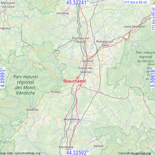
Beauchastel GPS coordinates[2]
44° 49' 33.132" North, 4° 48' 10.98" East
| Map corner | latitude | longitude |
|---|---|---|
| Upper-left | 45.32241°, | 4.09993° |
| Center: | 44.82587°, | 4.80305° |
| Lower-right: | 44.32502°, | 5.50618° |
| Map W x H: | 110.9×110.9 km | = 68.9×68.9mi |
| max Lat: | 51.07786° ⇑81.2% North |
| Beauchastel: | 44.82587° |
| min Lat: | ⇓18.8% South 41.3874° |
| min Long | Beauchastel | max Long |
| -5.08615° | 4.80305° | 9.52242° |
| W 75.1%⇐ | ⇒24.9% E |
Elevation
Elevation of Beauchastel is 110 m = 361 ft, and this is 83.7 m = 275 ft below average elevation for this country.
| Max E: |
2333 m = 7654 ft | 57.3% |
| Avg. | 193.7 m = 635 ft | |
| Beauchastel | 110 m = 361 ft | |
Min E: |
-1 m = -3 ft | 42.7% |
See also: France elevation on elevation.city.
Geographical zone
Beauchastel is located in North temperate zone (between Tropic of Cancer and the Arctic Circle). Distance of this Northern Tropic circle is 2378.3 km =1477.8 mi to South.| Distance of | km | miles | from Beauchastel |
|---|---|---|---|
| North Pole | 5022.9 | 3121.1 | to North |
| Arctic Circle | 2417 | 1501.9 | to North |
| Tropic Cancer | 2378.3 | 1477.8 | to South |
| Equator | 4984.2 | 3097 | to South |


Nearby cities:
15 places around Beauchastel: (largest is in red/bold)
• Allex
9.9 km =6.2 mi,  130°
130°
• Beauvallon
8.9 km =5.5 mi,  67°
67°
• Charmes-sur-Rhône
4.9 km =3 mi,  31°
31°
• La Voulte-sur-Rhône
3.5 km =2.2 mi,  212°
212°
• Le Pouzin
9.3 km =5.8 mi, 207°
• Livron-sur-Drôme
6.2 km =3.9 mi,  150°
150°
• Loriol-sur-Drôme
8.8 km =5.5 mi,  172°
172°
• Portes-lès-Valence
7.9 km =4.9 mi,  45°
45°
• Rompon
7.9 km =4.9 mi,  224°
224°
• Saint-Fortunat-sur-Eyrieux
10 km =6.2 mi,  272°
272°
• Saint-Georges-les-Bains
3.9 km =2.4 mi,  7°
7°
• Saint-Laurent-du-Pape
2.9 km =1.8 mi,  264°
264°
• Soyons
8 km =5 mi, 27°
• Toulaud
8.1 km =5 mi, 7°
• Étoile-sur-Rhône
7 km =4.3 mi,  78°
78°
Sources, notices
• [Note1] Compared only with cities in France existing in our database
• [Src1] Map data: © OpenStreetMap contributors (CC-BY-SA)
• [Src2] Other city data from geonames.org with taken over terms of usage.
• [Src3] Geographical zone / Annual Mean Temperature by Robert A. Rohde @ Wikipedia
