Saint-Fort-sur-Gironde geodata
Saint-Fort-sur-Gironde (Nouvelle-Aquitaine) is a populated place; located in France in Europe/Paris (GMT+2) time zone. With population of 918 people, there are 9502 cities with bigger population in this country. Compared to other cities in France, 74.5% of cities are located further ↑North; 85.8% of cities are located further →East and 92.4% of cities have higher elevation than Saint-Fort-sur-Gironde. Note1
Administrative division(s):
- Level 1: Nouvelle-Aquitaine
- Level 2: Charente-Maritime
- Level 3: Arrondissement de Jonzac
- Level 4: Saint-Fort-sur-Gironde
Current local time in Saint-Fort-sur-Gironde:
03:47 PM, SaturdayDifference from your time zone: hours


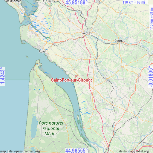
Saint-Fort-sur-Gironde GPS coordinates[2]
45° 27' 39.168" North, 0° 43' 16.212" West
| Map corner | latitude | longitude |
|---|---|---|
| Upper-left | 45.95189°, | -1.4243° |
| Center: | 45.46088°, | -0.72117° |
| Lower-right: | 44.96555°, | -0.01805° |
| Map W x H: | 109.7×109.7 km | = 68.2×68.2mi |
| max Lat: | 51.07786° ⇑74.5% North |
| Saint-Fort-sur-Gironde: | 45.46088° |
| min Lat: | ⇓25.5% South 41.3874° |
| min Long | Saint-Fort-sur- | max Long |
| -5.08615° | -0.72117° | 9.52242° |
| W 14.2%⇐ | ⇒85.8% E |
Elevation
Elevation of Saint-Fort-sur-Gironde is 24 m = 79 ft, and this is 169.7 m = 557 ft below average elevation for this country.
| Max E: |
2333 m = 7654 ft | 92.4% |
| Avg. | 193.7 m = 635 ft | |
| Saint-Fort-sur-Gironde | 24 m = 79 ft | |
Min E: |
-1 m = -3 ft | 7.6% |
See also: France elevation on elevation.city.
Geographical zone
Saint-Fort-sur-Gironde is located in North temperate zone (between Tropic of Cancer and the Arctic Circle). Distance of this North polar circle is 2346.4 km =1458 mi to North.| Distance of | km | miles | from Saint-Fort-sur-Gironde |
|---|---|---|---|
| North Pole | 4952.3 | 3077.2 | to North |
| Arctic Circle | 2346.4 | 1458 | to North |
| Tropic Cancer | 2448.9 | 1521.7 | to South |
| Equator | 5054.8 | 3140.9 | to South |


Nearby cities:
15 places around Saint-Fort-sur-Gironde: (largest is in red/bold)
• Arces
15.1 km =9.4 mi,  311°
311°
• Champagnolles
8.8 km =5.5 mi,  48°
48°
• Chenac-Saint-Seurin-d'Uzet
9.7 km =6 mi, 309°
• Cozes
16.2 km =10.1 mi,  327°
327°
• Cravans
15.1 km =9.4 mi,  3°
3°
• Gémozac
12.5 km =7.8 mi,  16°
16°
• Mirambeau
15.3 km =9.5 mi,  129°
129°
• Mortagne-sur-Gironde
5.6 km =3.5 mi,  293°
293°
• Nieul-le-Virouil
15.9 km =9.9 mi,  111°
111°
• Saint-André-de-Lidon
15.6 km =9.7 mi,  352°
352°
• Saint-Bonnet-sur-Gironde
12.7 km =7.9 mi,  157°
157°
• Saint-Ciers-du-Taillon
7.6 km =4.7 mi,  123°
123°
• Saint-Dizant-du-Gua
3.5 km =2.2 mi, 155°
• Saint-Genis-de-Saintonge
12.1 km =7.5 mi,  79°
79°
• Épargnes
11 km =6.8 mi,  324°
324°
Sources, notices
• [Note1] Compared only with cities in France existing in our database
• [Src1] Map data: © OpenStreetMap contributors (CC-BY-SA)
• [Src2] Other city data from geonames.org with taken over terms of usage.
• [Src3] Geographical zone / Annual Mean Temperature by Robert A. Rohde @ Wikipedia
