Sainte-Marthe geodata
Sainte-Marthe (Provence-Alpes-Côte d'Azur) is a section of populated place; located in France in Europe/Paris (GMT+2) time zone. With population of 3,808 people, there are 2580 cities with bigger population in this country. Compared to other cities in France, 95.1% of cities are located further ↑North; 81.8% of cities are located further ←West and 75% of cities have higher elevation than Sainte-Marthe. Note1
Administrative division(s):
- Level 1: Provence-Alpes-Côte d'Azur
- Level 2: Département des Bouches-du-Rhône
- Level 3: Arrondissement de Marseille
- Level 4: Marseille


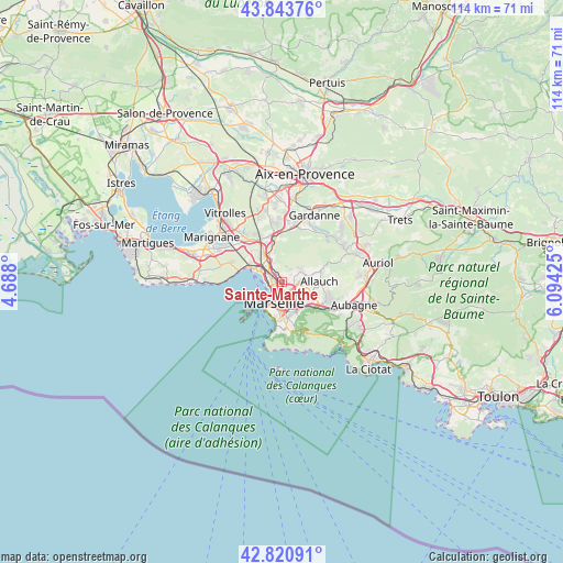
Sainte-Marthe GPS coordinates[2]
43° 20' 4.164" North, 5° 23' 28.032" East
| Map corner | latitude | longitude |
|---|---|---|
| Upper-left | 43.84376°, | 4.688° |
| Center: | 43.33449°, | 5.39112° |
| Lower-right: | 42.82091°, | 6.09425° |
| Map W x H: | 113.7×113.7 km | = 70.6×70.6mi |
| max Lat: | 51.07786° ⇑95.1% North |
| Sainte-Marthe: | 43.33449° |
| min Lat: | ⇓4.9% South 41.3874° |
| min Long | Sainte-Marthe | max Long |
| -5.08615° | 5.39112° | 9.52242° |
| W 81.8%⇐ | ⇒18.2% E |
Elevation
Elevation of Sainte-Marthe is 67 m = 220 ft, and this is 126.7 m = 416 ft below average elevation for this country.
| Max E: |
2333 m = 7654 ft | 75% |
| Avg. | 193.7 m = 635 ft | |
| Sainte-Marthe | 67 m = 220 ft | |
Min E: |
-1 m = -3 ft | 25% |
See also: France elevation on elevation.city.
Geographical zone
Sainte-Marthe is located in North temperate zone (between Tropic of Cancer and the Arctic Circle). Distance of this Northern Tropic circle is 2212.4 km =1374.7 mi to South.| Distance of | km | miles | from Sainte-Marthe |
|---|---|---|---|
| North Pole | 5188.7 | 3224.1 | to North |
| Arctic Circle | 2582.8 | 1604.9 | to North |
| Tropic Cancer | 2212.4 | 1374.7 | to South |
| Equator | 4818.3 | 2994 | to South |


Nearby cities:
15 places around Sainte-Marthe: (largest is in red/bold)
• Bon-Secours
1.8 km =1.1 mi,  198°
198°
• La Cabucelle
2.4 km =1.5 mi,  263°
263°
• La Delorme
1.8 km =1.1 mi,  305°
305°
• Le Canet
1.8 km =1.1 mi,  238°
238°
• Le Merlan
1.4 km =0.9 mi,  70°
70°
• Les Arnavaux
0.9 km =0.6 mi,  273°
273°
• Les Crottes
2.3 km =1.4 mi, 235°
• Malpassé
2.4 km =1.5 mi,  125°
125°
• Marseille 13
2.3 km =1.4 mi,  141°
141°
• Marseille 14
1.4 km =0.9 mi,  321°
321°
• Saint-Barthélémy
1 km =0.6 mi,  112°
112°
• Saint-Joseph
1.6 km =1 mi, 324°
• Saint-Just
2.3 km =1.4 mi,  148°
148°
• Saint-Jérôme
2.1 km =1.3 mi,  91°
91°
• Saint-Mauront
2.5 km =1.6 mi,  211°
211°
Sources, notices
• [Note1] Compared only with cities in France existing in our database
• [Src1] Map data: © OpenStreetMap contributors (CC-BY-SA)
• [Src2] Other city data from geonames.org with taken over terms of usage.
• [Src3] Geographical zone / Annual Mean Temperature by Robert A. Rohde @ Wikipedia
