Colroy-la-Grande geodata
Colroy-la-Grande (Grand Est) is a populated place; located in France in Europe/Paris (GMT+2) time zone. With population of 616 people, there are 13048 cities with bigger population in this country. Compared to other cities in France, 64.8% of cities are located further ↓South; 95.3% of cities are located further ←West and 89.8% of cities have lower elevation than Colroy-la-Grande. Note1
Administrative division(s):
- Level 1: Grand Est
- Level 2: Vosges
- Level 3: Arrondissement de Saint-Dié-des-Vosges
- Level 4: Provenchères-et-Colroy


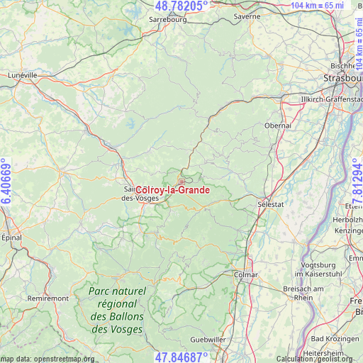
Colroy-la-Grande GPS coordinates[2]
48° 18' 59.76" North, 7° 6' 35.316" East
| Map corner | latitude | longitude |
|---|---|---|
| Upper-left | 48.78205°, | 6.40669° |
| Center: | 48.3166°, | 7.10981° |
| Lower-right: | 47.84687°, | 7.81294° |
| Map W x H: | 104×104 km | = 64.6×64.6mi |
| max Lat: | 51.07786° ⇑35.2% North |
| Colroy-la-Grande: | 48.3166° |
| min Lat: | ⇓64.8% South 41.3874° |
| min Long | Colroy-la-Grand | max Long |
| -5.08615° | 7.10981° | 9.52242° |
| W 95.3%⇐ | ⇒4.7% E |
Elevation
Elevation of Colroy-la-Grande is 422 m = 1385 ft, and this is 228.3 m = 749 ft above average elevation for this country.
| Max E: |
2333 m = 7654 ft | 10.2% |
| Colroy-la-Grande | 422 m 1385 ft | |
| Avg. | 193.7 m = 635 ft | |
Min E: |
-1 m = -3 ft | 89.8% |
See also: France elevation on elevation.city.
Geographical zone
Colroy-la-Grande is located in North temperate zone (between Tropic of Cancer and the Arctic Circle). Distance of this North polar circle is 2028.9 km =1260.7 mi to North.| Distance of | km | miles | from Colroy-la-Grande |
|---|---|---|---|
| North Pole | 4634.8 | 2879.9 | to North |
| Arctic Circle | 2028.9 | 1260.7 | to North |
| Tropic Cancer | 2766.4 | 1719 | to South |
| Equator | 5372.3 | 3338.2 | to South |


Nearby cities:
15 places around Colroy-la-Grande: (largest is in red/bold)
• Ban-de-Laveline
8.6 km =5.3 mi,  202°
202°
• Fouchy
12 km =7.5 mi,  84°
84°
• La Croix-aux-Mines
11.7 km =7.3 mi, 202°
• Maisonsgoutte
12 km =7.5 mi,  70°
70°
• Nayemont-les-Fosses
7.9 km =4.9 mi,  253°
253°
• Plaine
11.5 km =7.1 mi,  13°
13°
• Provenchères-sur-Fave
2.5 km =1.6 mi, 246°
• Rombach-le-Franc
11.9 km =7.4 mi,  108°
108°
• Saales
3.7 km =2.3 mi,  356°
356°
• Saint-Dié-des-Vosges
12.4 km =7.7 mi, 252°
• Sainte-Croix-aux-Mines
10.6 km =6.6 mi,  124°
124°
• Sainte-Marguerite
10.8 km =6.7 mi,  239°
239°
• Sainte-Marie-aux-Mines
9.5 km =5.9 mi,  144°
144°
• Senones
13 km =8.1 mi,  311°
311°
• Steige
10.5 km =6.5 mi,  61°
61°
Sources, notices
• [Note1] Compared only with cities in France existing in our database
• [Src1] Map data: © OpenStreetMap contributors (CC-BY-SA)
• [Src2] Other city data from geonames.org with taken over terms of usage.
• [Src3] Geographical zone / Annual Mean Temperature by Robert A. Rohde @ Wikipedia
