Saint-Clair-de-Halouze geodata
Saint-Clair-de-Halouze (Normandy) is a populated place; located in France in Europe/Paris (GMT+2) time zone. With population of 860 people, there are 9991 cities with bigger population in this country. Compared to other cities in France, 72.7% of cities are located further ↓South; 84.8% of cities are located further →East and 66.4% of cities have lower elevation than Saint-Clair-de-Halouze. Note1
Administrative division(s):
- Level 1: Normandy
- Level 2: Département de l'Orne
- Level 3: Argentan
- Level 4: Saint-Clair-de-Halouze
Current local time in Saint-Clair-de-Halouze:
07:39 PM, SaturdayDifference from your time zone: hours


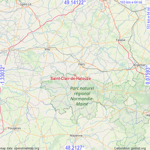
Saint-Clair-de-Halouze GPS coordinates[2]
48° 40' 44.76" North, 0° 37' 37.884" West
| Map corner | latitude | longitude |
|---|---|---|
| Upper-left | 49.14122°, | -1.33032° |
| Center: | 48.6791°, | -0.62719° |
| Lower-right: | 48.2127°, | 0.07593° |
| Map W x H: | 103.2×103.2 km | = 64.1×64.1mi |
| max Lat: | 51.07786° ⇑27.3% North |
| Saint-Clair-de-Halouze: | 48.6791° |
| min Lat: | ⇓72.7% South 41.3874° |
| min Long | Saint-Clair-de- | max Long |
| -5.08615° | -0.62719° | 9.52242° |
| W 15.2%⇐ | ⇒84.8% E |
Elevation
Elevation of Saint-Clair-de-Halouze is 201 m = 659 ft, and this is 7.3 m = 24 ft above average elevation for this country.
| Max E: |
2333 m = 7654 ft | 33.6% |
| Saint-Clair-de-Halouze | 201 m 659 ft | |
| Avg. | 193.7 m = 635 ft | |
Min E: |
-1 m = -3 ft | 66.4% |
See also: France elevation on elevation.city.
Geographical zone
Saint-Clair-de-Halouze is located in North temperate zone (between Tropic of Cancer and the Arctic Circle). Distance of this North polar circle is 1988.6 km =1235.7 mi to North.| Distance of | km | miles | from Saint-Clair-de-Halouze |
|---|---|---|---|
| North Pole | 4594.5 | 2854.9 | to North |
| Arctic Circle | 1988.6 | 1235.7 | to North |
| Tropic Cancer | 2806.7 | 1744 | to South |
| Equator | 5412.6 | 3363.2 | to South |


Nearby cities:
15 places around Saint-Clair-de-Halouze: (largest is in red/bold)
• Champsecret
9.6 km =6 mi,  144°
144°
• Chanu
6.6 km =4.1 mi,  327°
327°
• Domfront
9.8 km =6.1 mi,  188°
188°
• Flers
7.5 km =4.7 mi,  30°
30°
• La Chapelle-au-Moine
4.6 km =2.9 mi,  44°
44°
• La Ferrière-aux-Étangs
8.1 km =5 mi,  103°
103°
• La Haute-Chapelle
8.8 km =5.5 mi,  200°
200°
• La Lande-Patry
9.5 km =5.9 mi,  12°
12°
• La Selle-la-Forge
8.7 km =5.4 mi,  46°
46°
• Landisacq
8.7 km =5.4 mi,  349°
349°
• Messei
7.5 km =4.7 mi,  61°
61°
• Saint-André-de-Messei
7.8 km =4.8 mi,  77°
77°
• Saint-Bômer-les-Forges
3.9 km =2.4 mi, 186°
• Saint-Cornier-des-Landes
8 km =5 mi,  302°
302°
• Saint-Paul
7 km =4.3 mi,  356°
356°
Sources, notices
• [Note1] Compared only with cities in France existing in our database
• [Src1] Map data: © OpenStreetMap contributors (CC-BY-SA)
• [Src2] Other city data from geonames.org with taken over terms of usage.
• [Src3] Geographical zone / Annual Mean Temperature by Robert A. Rohde @ Wikipedia
